
Cathy Tsai | 蔡凱西 台北人 / 不專業旅人 / 流浪中的學術人 / 研究旅行史與旅行文化的不良歷史學徒/《後綴》假掰文青誌編輯群 在出門旅行、閱讀,與作古的旅記文本中持續穿越 佛系粉專:https://www.facebook.com/travelhistorystory 合作邀約:misiaa2001@gmail.com
Auxiliary pictures for early Western travel guides, once a window to lead travelers to explore the unknown world
This article was originally an invited contribution to "The Affairs Weekly Compilation" and was published in the special issue of "The Annie Time" (The Annie Time), No. 11 (June 10, 2002). A publication cooperating with the Ministry of Education, aiming at promoting young people's understanding and contact with newspapers and periodicals, and fostering participation in issues and aesthetic literacy. The original title is "An Early "Tourism Book for Exploring the Unknown World", which is now renamed, revised and forwarded, with more pictures attached.
Walking into the travel counter of the bookstore, you can see a variety of travel guides with pictures, including information on accommodation and sightseeing, categorized by country and region. For example, it was founded in Australia in 1972, and now it is "Lonely Planet" (Lonely Planet), which is known as the "self-help travel bible" and has been published in multiple languages.

The upsurge in the publication of travel guides is related to the modern tourism industry and its development in the middle of the 19th century. Thomas Cook of the United Kingdom founded the world's first travel company, which is now commonly known as a travel agency, promoting group travel and various agency businesses in the United Kingdom.
Cook used his original publishing and printing business to print travel itineraries for members of the tour group, including transportation routes, train times, and information on the destination city's accommodation, attractions, etc., all from Cook's field. visit. The travel guide was incorporated into the travel agency business, a first for Cook. Since then, travel guides and tourism have gradually become closely linked.
Cook's travel business has gradually expanded to Europe, Asia and Africa, and New Zealand and Australia in the southern hemisphere, and even organized a one-week tour around the world. Tourism not only stimulates the growth of the European tourist population, but also encourages other European publishers to put more effort into writing travel guides about cities, countries and regions.
The pioneer travelers created something from scratch through local exploration and investigation. They organized and classified the information they obtained in the local area, and then made a book by the publisher, and gradually revised and republished in response to the outdated and updated information. The travelers who arrive later carry the tourist guidebooks that have been systematically organized and classified as a reference guide for the journey.
Colorful text and photographic pictures are displayed together, which is our common impression of today's travel book guides. However, in the layout and printing of travel guidebooks a hundred years ago, text is the main feature, supplemented by images, which is the most basic feature.
Most of the travel guides at that time were written by readers with higher knowledge and reading comprehension. The text, which occupies a very high proportion of the whole book, conveys to readers a large amount of exotic knowledge such as history and geography, humanities, religion, art, and historical sites; followed by information on travel routes, food, lodging, and transportation along the way.
As for the images that supplement the text description in the book, they are mainly drawn maps, illustrations, and landscape photos of historical sites and black-and-white photography. I imagine that I am about to go to those worlds, the farther away from me, the more different the history and culture from myself. The maps, illustrations, and landscape photos interspersed in the book play an important role for travelers.
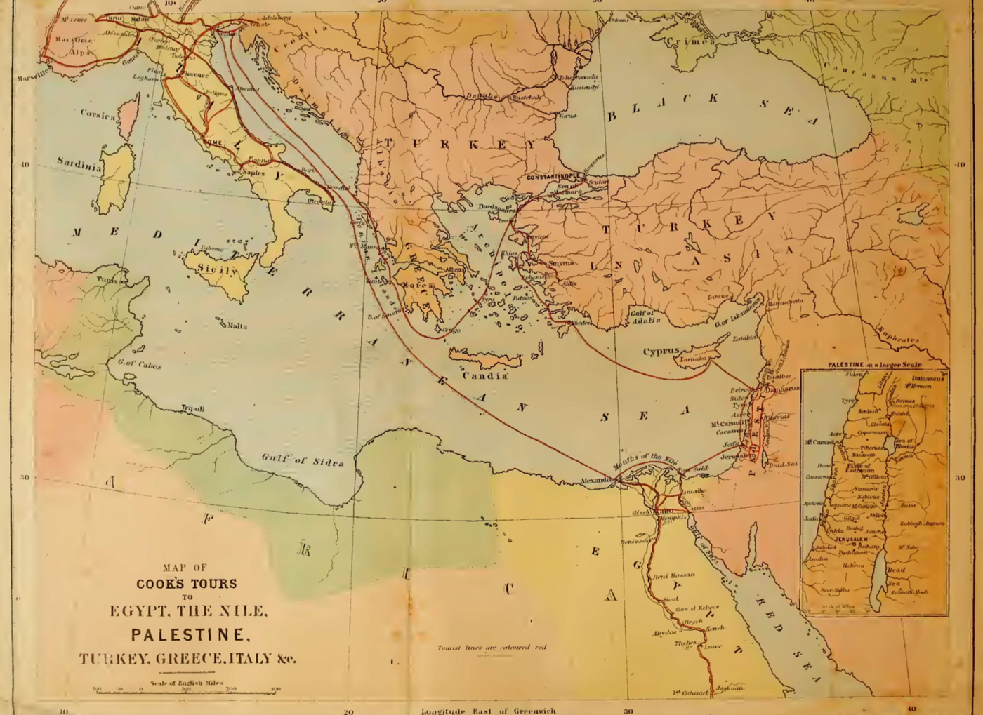
Well-drawn maps were the selling point of early travel books. For example, in the 1870s, when Cook's tourism industry entered Egypt and Palestine, which have a heritage of thousands of years of ancient civilizations, they compiled and printed a travel book called "Up the Nile by Steam". "SPECIALLY DESIGN MAPS" is printed on it, and after that, you can also see various travel books, and the home page emphasizes how many maps are included.
"Up the Nile by Steamboat" first uses a panoramic map around the Mediterranean Sea, using different color blocks to present the political plates at the junction of southern Europe, North Africa, the Middle East and Eurasia, and uses red lines to depict the land and sea lines of communication. Regions, islands, harbors.
From far to near, "Up the Nile by Steamboat" also draws maps of Egypt and Palestine, using color blocks and lines to describe the bays, watersheds, lakes, topography, shipping routes, and city names in the region in more detail. Like the map of the Nile River Basin, the red line is still used as a schematic line for waterway traffic. From the lower to the upper reaches of the Nile River, the deserts and place names of Lower Egypt, Middle Egypt and Upper Egypt are clearly marked in detail.
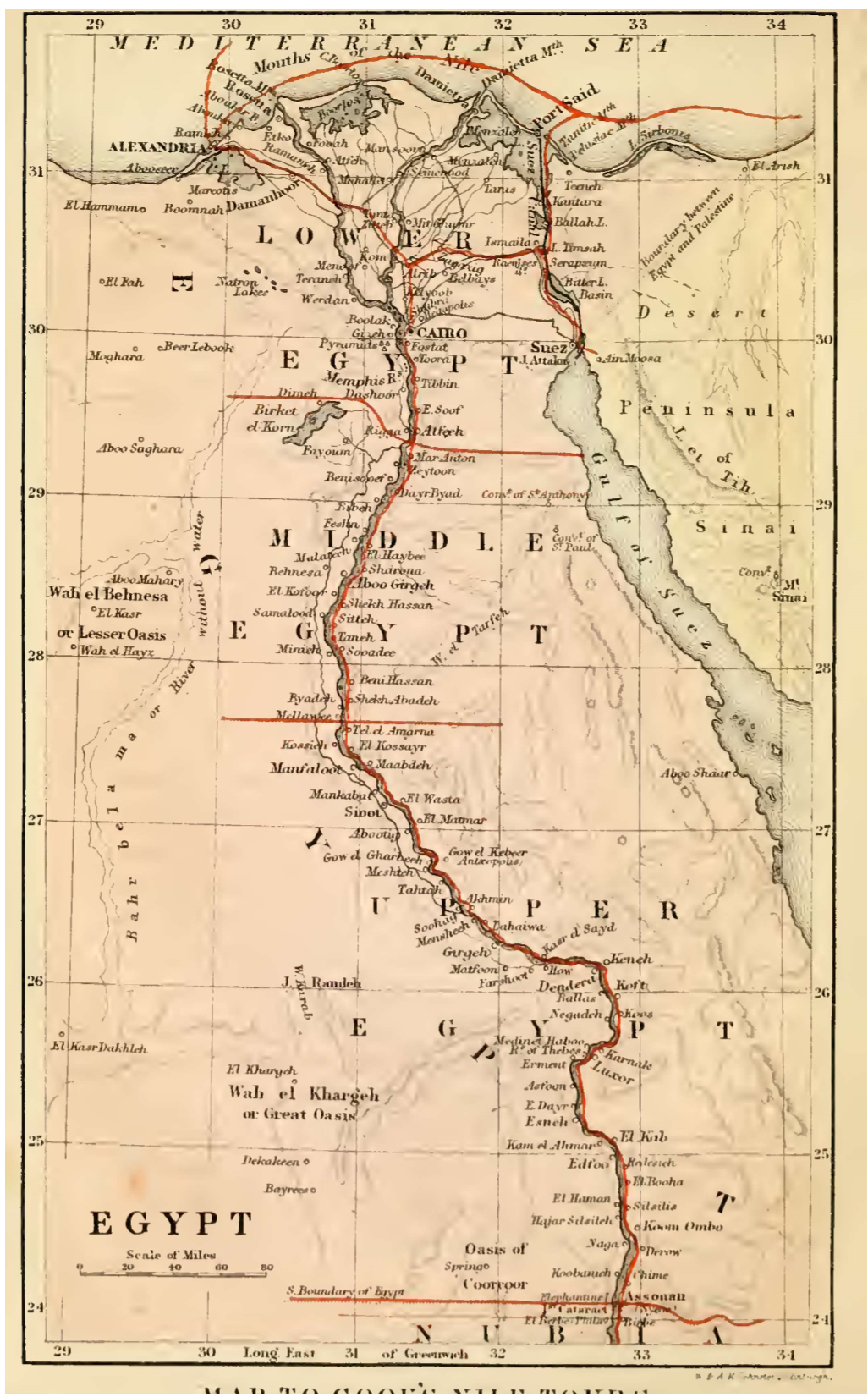
In order to provide readers with a basic geographical overview of the destination, the drawing of several regions, or full or zonal maps of the country, was an indispensable element in the compilation of early travel guides.
As Cook's tourism continues to spread around the world, only travel guides compiled into maps can no longer satisfy readers by reading on paper, further attracting them to step out of their homes and visit those remote and unknown countries in the book. Therefore, in the process of revision and revision of the travel guide, various image elements have been gradually added.
Take the travel guide book "The Nile: Notes for Travellers in Egypt" published by Cook at the end of the 19th century as an example. In the process of continuous revision, in addition to the maps still drawn in the book; The color cover, the Egyptian-style English font book title, surrounded by hieroglyphs, tries to attract readers to understand the mysterious ancient Egyptian civilization through this book; as for the inner page, it is equipped with richer ancient Egyptian characters, buildings, murals and other black and white tones illustration.
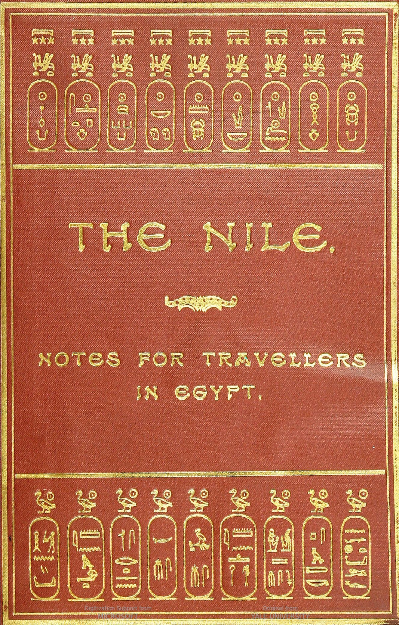
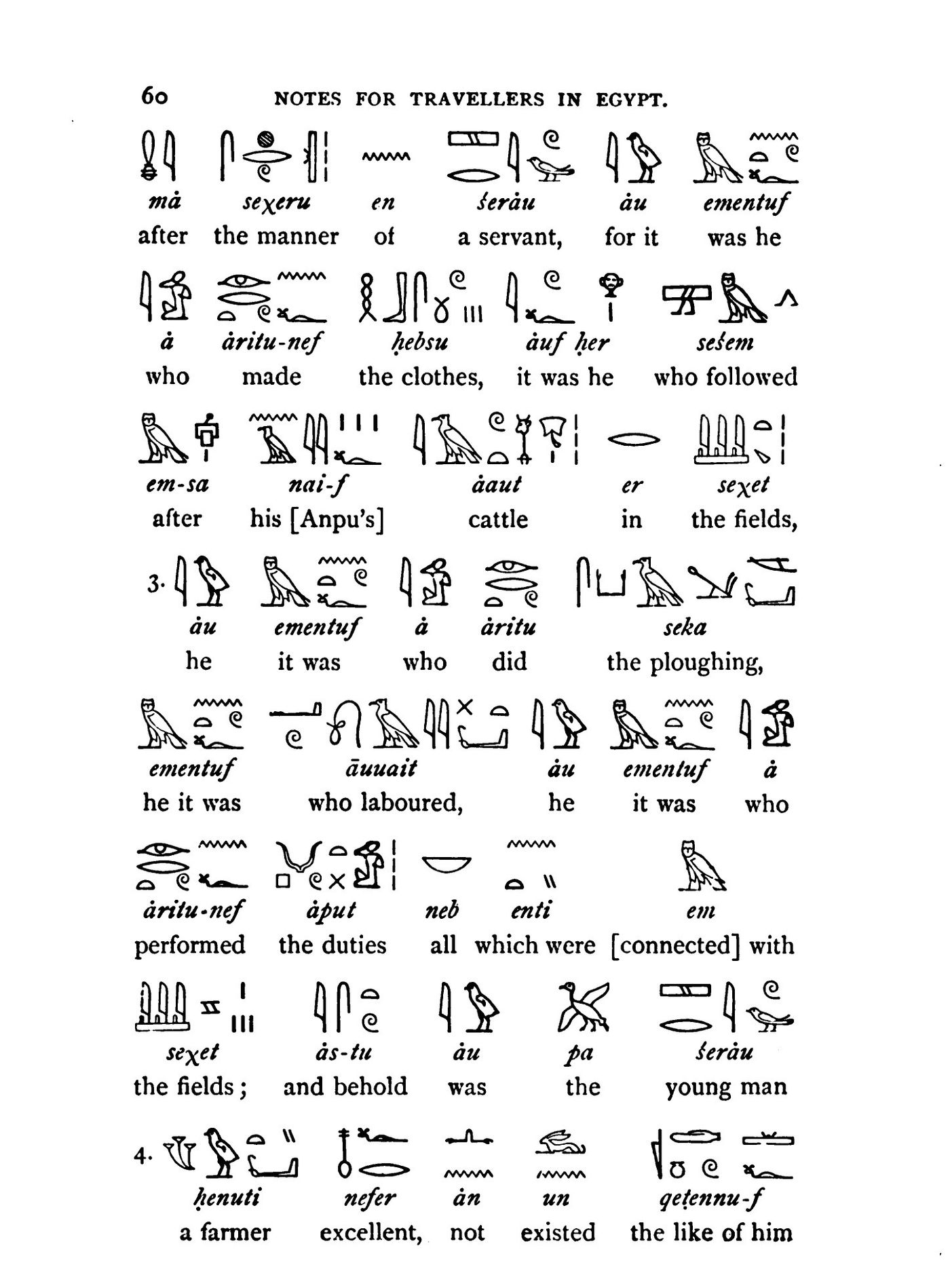
The increase of European and American photography enthusiasts, and the innovation of photography technology and equipment at the end of the century, the travel guides issued by Cook have gradually kept up with this trend. Entering the 20th century, the pictures of cultural heritage and landscape photography of tourist destinations are in the library. In the gram company's travel guide, the role is more important.
In addition to the new edition of the 20th century Egypt Travel Guide, which added a number of real-life photos of the existing ruins; in 1910, Cook also issued a book entitled "Beijing, Tianjin, Shanhaiguan, Fengtian, Dalian, Lushun and Seoul Travel Handbook" (Cook's handbook for tourists) to Peking, Tientsin, Shan-Hai-Kwan, Mukden, Dalny, Port Arthur, and Seoul), photographs are used in the inside pages to present the Great Wall, the Forbidden City, Ming Tombs, the Russo-Japanese War, and the colonization of the South Manchurian Railway Construction and other tourist attractions are more common.
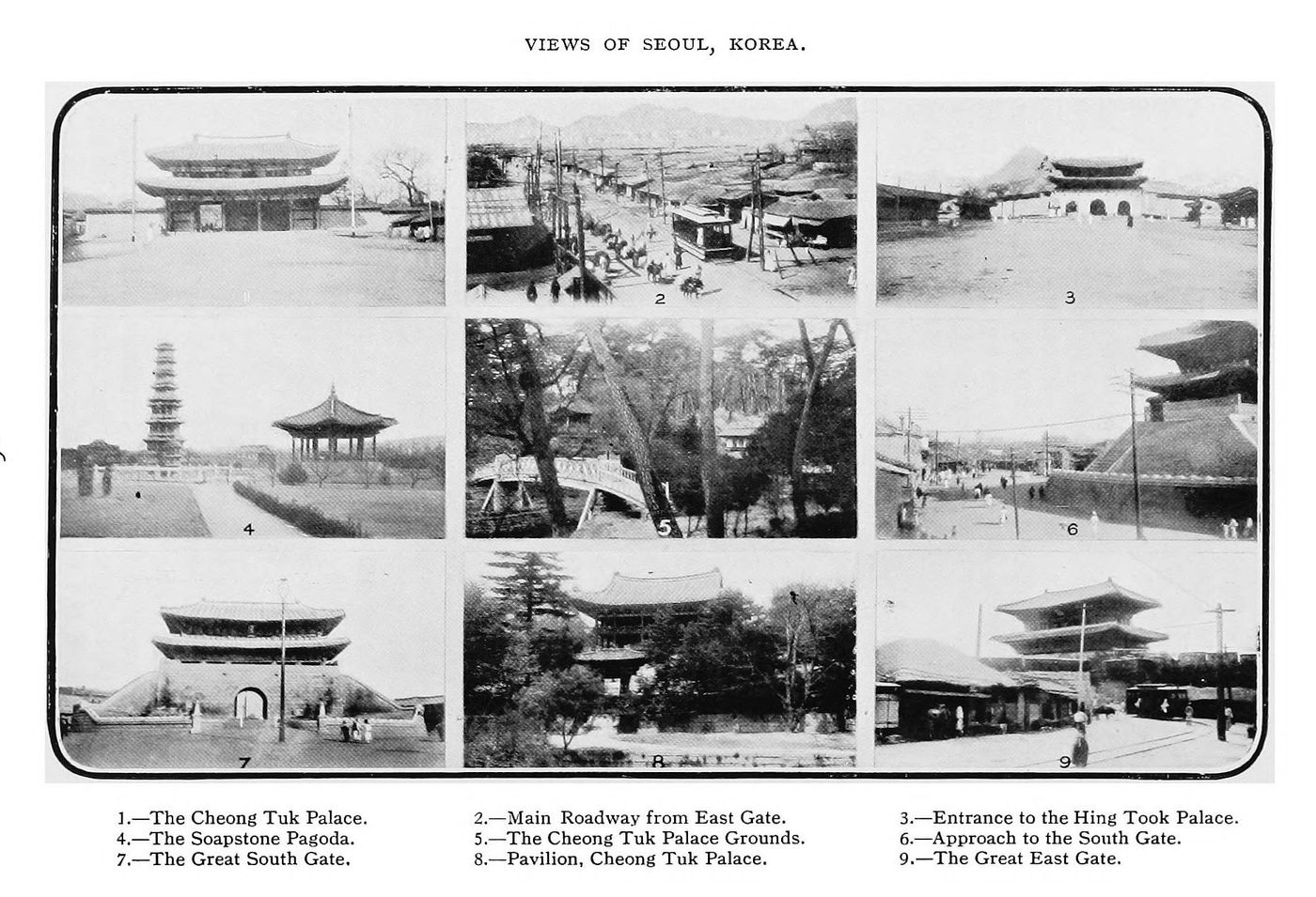
Cook is not alone in publishing travel guides in Europe. John Murray, a British company, is also a publishing giant that distributes travel guides. In the eyes of European and American travelers, Japan, an island country in East Asia, is undoubtedly a country full of unfamiliar and incredible history and culture. Since the Meiji Restoration, European and American people have gradually traveled to Japan. John Murray has been publishing Japanese travel guides since the 1880s, which is a feature that Cook's travel book series does not have.
John Murray's travel guides to Japan range from the late 1890s to the early 20th century, with titles ranging from "A handbook for travellers in central & northern Japan" in the 1880s to "Handbook for Travelers in Imperial Japan" in 1907: From Sakhalin to Taiwan (A Handbook for travellers in Japan including the whole empire from Saghalien to Formosa). Traces of frequent revisions and reprints by the Information Office. A map of Taiwan appeared in Murray's Japan Travel Guide, first in 1899.
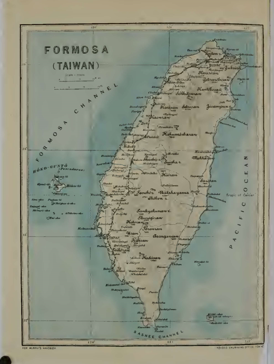
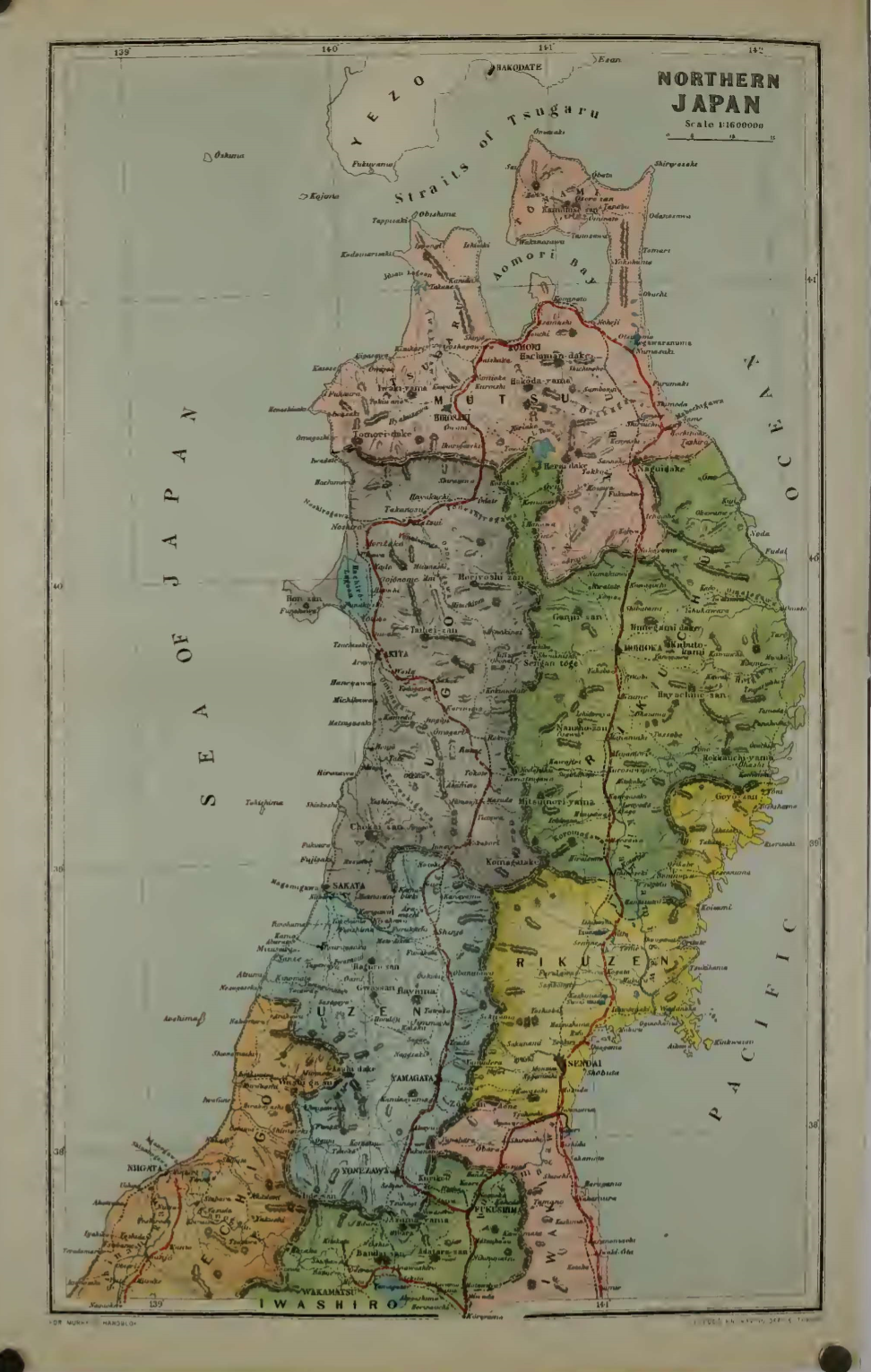
John Murray's Japanese travel guide book series does not use photographs to add highlights to the text as Cook does, but it is still dominated by drawn maps, folios and illustrations. The maps and folios have been updated year by year from the first dozen or so. According to the statistics of the editions I have at hand, there are 17 in the 1891 edition, 26 in the 1898 edition, 28 in the 1899 edition, 28 in the 1901 edition, 28 in the 1903 edition, The 1907 edition has a total of 30 pieces, and the 1913 edition has a total of 30 pieces.
Murray's guide includes full maps of Japan's territory, geographic divisions, port cities, tourist attractions, and even the distribution of rainfall across the country, all in color. For example, the map of the northeast uses different color blocks to divide the geographical area of the northeast, the names are marked with the ancient imperial state, the red line is the railway line, and important cities such as Sendai, Fukushima, Yamagata, Niigata, etc., are marked with Subordinate uppercase font designation.
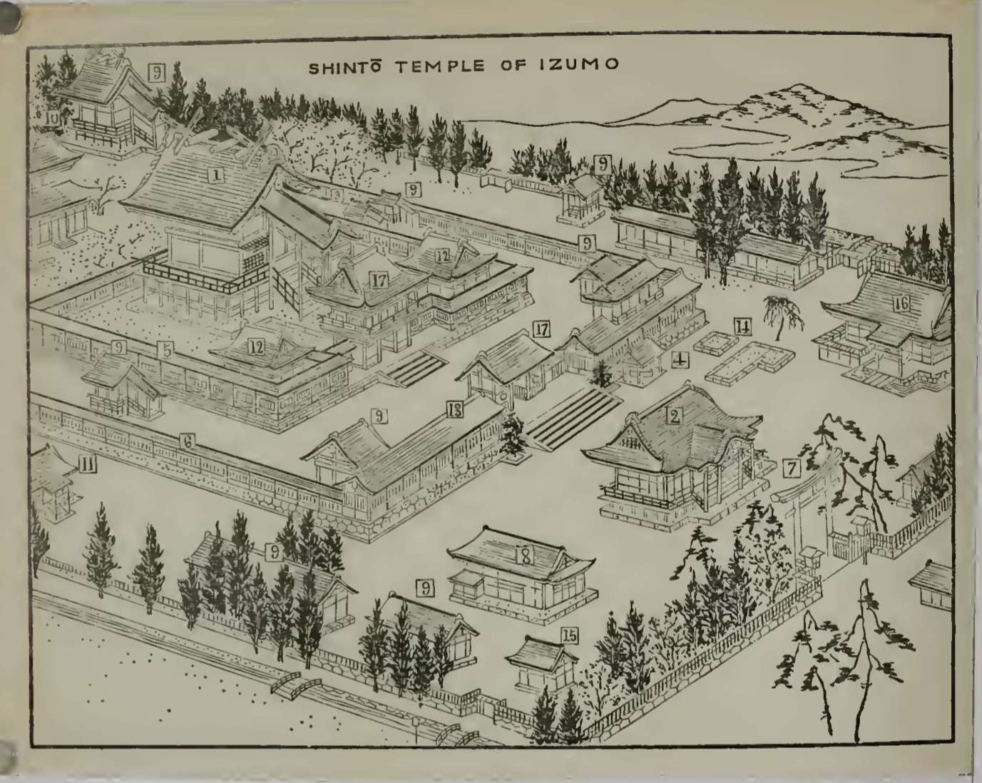
As for the folded pages and the illustrations in the text, it depicts the bird's-eye view of the ancient temples and shrines, the panoramic view of the city, and the images of many gods and Buddhas, as well as the shapes of temples, torii gates, and totem utensils. For example, the famous Izumo Taisha Shrine in Shimane Prefecture is now hung with a huge beading rope, leaving tourists with an indelible image of the landscape. This object has not yet been seen in the drawing of the Izumo Taisha Shrine in Murray's guide.
In addition, in the text introducing Shinto and Buddhist beliefs, there are many illustrations of imperial coins, utensils, tombs, and images of ghosts and gods, such as the appearance of Fengshen, Thor, Tengu, and the shape of towers, etc., leading Western travelers to understand Japan's complex Deities and religious rituals.
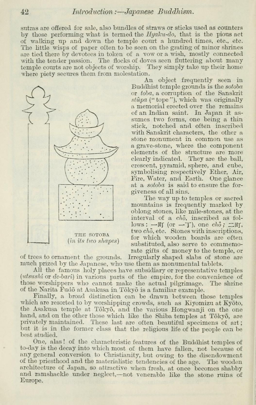
Although the set readers of the travel guide a hundred years ago were not the general public today, the arrangement of pictures and texts in the guide book is for modern people who are accustomed to colorful reading experiences and receive real-time, local travel moving images. Perhaps it can't be called too much visual beauty, and the old and outdated guide text may be difficult to provoke your and my travel vision. However, the birth and evolution of these early travel guides is to understand the legacy left by modern Westerners to explore the unknown through the textual and graphic guidance of travel and books.
- Appreciate Citizen 2.0 Subscription Sponsorship: https://liker.land/cathytsai/civic
- A Buddhist fan who doesn't work hard on Facebook: " Those things travel history taught me "
- You'll see me here too:Checkered VOCUS | Medium | hkese.net
- If you want to cooperate, you can come to me here: misiaa2001@gmail.com
- Welcome to my share referral link: MAX Exchange | Noise.cash
Like my work?
Don't forget to support or like, so I know you are with me..
Comment…