Why are maps fascinating?
I always thought that reading a map was the most enjoyable thing in the world.
Under the transparent rubber pad of the middle school desk, there is a trial map sent by Outdoor Life, which was just starting out back then and has now become the leader of map publishing in Taiwan.
When I get a geography textbook at the beginning of the semester, I always have to scan all the maps with overlapping latitudes and longitudes and alternating runoff, and then turn all other textbooks into my private geography textbooks, because I do nothing else in class, except in the blanks of the textbook. Draw imaginary landscapes, cities, and cobweb-like subway maps.
Indeed, what could be more fascinating than a map?
It exists in the minds of many people as an informative image of an encyclopedia and a guide; to me, it's a lot like poetry. They are both conscious human references to signs, and signs and their contents are open and arbitrary in both. Standardized finite symbols connect infinite meanings in the real world.
Being in it, the reader always has the greatest autonomy, can decode the symbols, and then wander between the ambiguity of the imagination and the realization of the truth.
Faced with a map, you don't even have a verse, let alone discipline or a designated reading direction. Not to mention that blank spot on the map that seems to be missing, but you always know "there must be something".
Until I started to carry a large backpack, I first carried a paper map folded into small squares (habitually drew the walking route on it and wrote down my travel feelings), and then I followed the map with the Google Map on the LCD screen. The entire world map is marked with yellow stars by me.
But really, I really like the paper age before Google Maps was born.
When I was a child, I went abroad to play. Every time I went to a place, I would collect all kinds of maps, including official sightseeing maps, atlases bought in bookstores, and advertising flyers disguised as maps.
Especially tourist maps, I now have a bunch of them in my drawer.
Although they are tattered and yellowed now, when I travel, I always draw the route of roaming and walking in the city directly on the map. Whether it is the route itself or the existence of the paper entity, it is the embodiment of the travel memory—— This is a point that is difficult to replace with google maps now.
But another thing that attracts me the most about paper maps is their “untidy” nature. In comparison, google maps are convenient, but basically no matter where they are, the user interface is the same, and the map drawing style is similar.
However, the paper maps are not neatly "adapted to local conditions". For me, they are often the "instructions" of a certain society and culture.
In this regard, maps are actually the same as language textbooks for beginners in that they reflect the appearance of a certain culture on the side.
For example, in French textbooks, love stories are used as texts, and in the word list of Russian textbooks in the Soviet period, there is always a legacy of the Soviet Union. ???
As for the texts in the Arabic textbooks, there are many discussions on politics, which can indeed reflect the interest of the modern world in Arab countries, which are often based on geopolitics.
In addition, when I was studying Alvin in Kuwait, the word list in the first lesson of the textbook had the word supervisor/boss (مدير), which was strange at the time. It was only later discovered that there are a large number of migrant workers in the Gulf region, so the word "supervisor" does appear very often in daily life-because for migrant workers, most of the local Arabs they can meet are theirs Bosses and supervisors.
Maps have the same function.
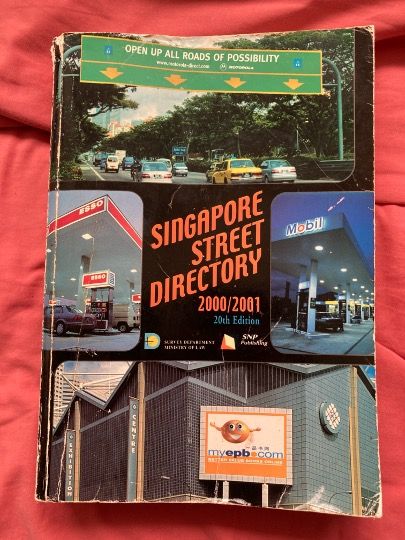
For example, last week I dug up an atlas I bought in Singapore 20 years ago for a field experience sharing.
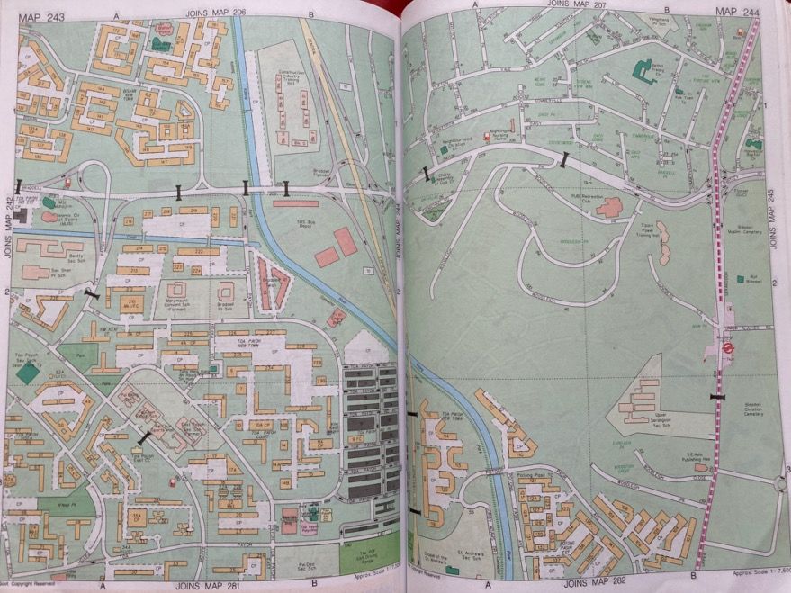
The reason why I want to share this map of Singapore is because I think that map is a slice of Singapore, and it is also very suitable to confirm the "stereotype" of Singapore by outsiders.
The map was only printed in a few simple colors. Except for the road name and the building name, there was nothing on the map. It was like an engineering drawing for engineers. It was neat and boring. .
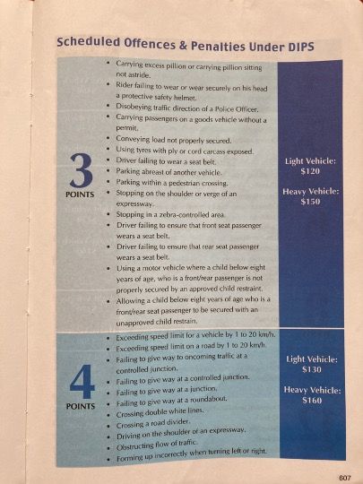
The most interesting thing is that when the map is turned to the end, there is actually a full list of various traffic penalties, telling passersby how many points will be deducted and how much they will be fined if they violate the rules. It is indeed a fine fine fine Singapore …


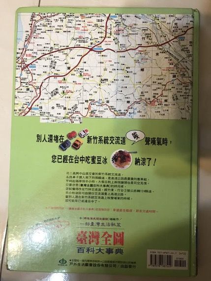
In contrast, maps from the same period in Taiwan (such as the "Outdoor Life" map I used to love) often have gourmet snacks densely marked on them.
Even a certain version of the outdoor life map, the promotional slogan is "When others are still stuck in the Hsinchu system interchange, you have already eaten honey bean ice in Taichung" - it really reflects that Taiwan's expressways were always congested back then. , The cultural spirit that everyone is always looking for food when they drive out to play XD

The instructions for using the map of Denmark that I wrote before can actually reflect similar characteristics: the map as a "map usage example" depicts an "unreal place", but it is also the most "real" map of Denmark, because it is similar to the map of Denmark. Like the legend, it reflects the prototype of the landscape in Denmark, thus giving the map a value similar to "ethnic semantics", which not only provides us with a representation of the external world and provides guidance, but is also a tangible carrier of culture.
Really charming, isn't it?
Like my work? Don't forget to support and clap, let me know that you are with me on the road of creation. Keep this enthusiasm together!


