Southeastern Okinawa Tour|Okinawa Self-Guided Travel Experience
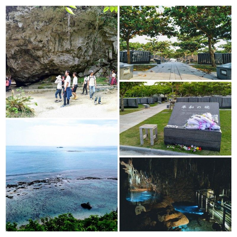
The next day, we rented a scooter and started our exploration of the southeast. Because when I looked at the Google Map plan in Taiwan before, I felt that although this block was large, the attractions were scattered, so I planned to walk around and see the flowers in one day. But later I found out that there should be a lot of secret realms in this area. If you really want to take a trip to the secret realm, I think one day is not enough.
Due to the longer route of the southeast tour, our stop time is short, and some scenic spots may not be detailed or provide photos, please refer to Haihan.
Saiba Mitake
In ancient Okinawa (Ryukyu Kingdom), "Mitake" was a place for religious ceremonies, a place where gods and human beings came into contact, somewhat similar to the concept of a shrine or a temple. The Saiba Mitake is the place where the legendary Ryukyu god Amo Miku descended, so the "Mitake" here is of a higher level. It can be said to be the most noble sanctuary in Okinawa, and it is also one of the scenic spots included in the World Heritage.
Strictly speaking, I don't think the atmosphere of Saiba Mitake can be regarded as a "spot", because after listening to these instructions, I feel that it is too sacred. what photo to take).
But it is really a tourist attraction in the local area, and most of the people who go there are really tourists. So from the very beginning, the local management will play a video to emphasize the sacredness of the place, and if they encounter people who are praying, they will never disturb them (such as taking pictures rashly).
transportation
There is its own parking lot . After parking, you have to buy a ticket at the ticket booth next to it, and then walk up the slope next to the post office outside. There is no parking lot for ordinary tourists on the slope.
Venues and routes
The entire restaurant is not very big , and you can walk it in about ten minutes with good foot strength (not including the time to stop and take pictures). Most of it is limestone terrain. Magnificent, but also worth seeing.
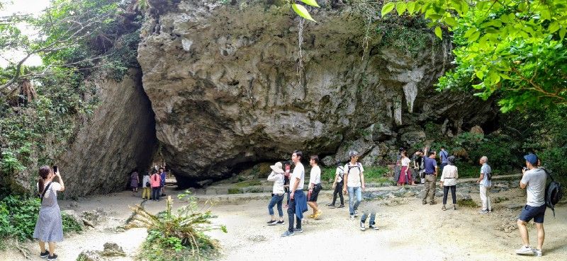
The most famous of them should be "Sankuli", which is composed of two large rocks merged, and only exposes the landscape of a passage in the middle. A lot of people gathered here to take pictures.
Chinen Cape
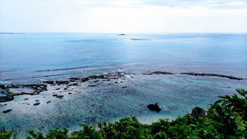
Walk in the opposite direction from the road next to the Saiba Mitake parking lot, and you can reach Chinen Cape Park in about five minutes. You can view the sea below from a cliff, which is very spectacular. Most of the beaches in the southeast are shallow intertidal zones, with numerous small reefs and clear blue waters interweaving into a picturesque and dreamlike scenery.
The bridge next to the park I found seemed to have an unpaved path leading to the coast below, I guess. But due to time constraints, we decided not to explore further. Friends who are interested and have time, you can take a look for yourself after you get there.
Hundred Names ビーチ
Translation: Hundred Names Beach
The word "ビーチ" means beach, which is homophonic with beach and is a foreign word in Japanese. If you open the map of the southeast, you should see "XXX ビーチ" everywhere along the coast, which shows the density of Okinawa beaches, and each of them is very clear.
transportation
On the way to Baiming Beach, you will pass through a narrow concrete road, and cars cannot meet cars. Friends who drive there must be careful! Because the locomotive is more maneuverable, there is no problem. After riding to the gravel road that is not paved with cement, stop and go down (you must park on the gravel road, not on the cement road).
On the way, you will pass another small Mitake, Hamagawa Mitake . If you encounter people who are engaged in prayer ceremonies, please do not disturb them.
view
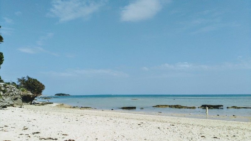
I don't know if it's a long way from Naha. There are not many people at Hundred Beach, and only one family and two people are encountered. When we went, the tide was shallow, the reefs were exposed on the sea, and the ecology was similar to the intertidal zone. From the photo, you can see that the water is shallow in a wide range. Even if you go far outside, the water will not reach your waist. It is very suitable for the whole family to play.
If you keep walking along the coastline to the left, you will enter... er... a place where many people sunbathe before arriving at Aーヂ Island , which is inaccessible because it is a private island.
Owu Island
The reason why I came here is mainly because my travel companions found out that this is a cat island on the Internet, so I decided to come, but I didn't see a few, and the water quality of the beach here is poor because it is close to the fishing port (that is, after getting close to it). It will smell the smell that is not very good), so it did not stay for too long.
There is only one photo I took with Ryugujin.
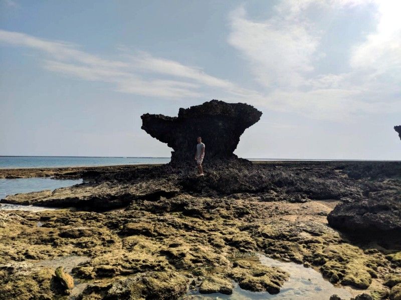
Dragon God
In fact, Ryugujin is a mushroom-shaped rock formed by the erosion of the reef rock. This kind of landscape can be said to be spread all over the southeastern coast of Okinawa, but because this mushroom-shaped rock is said to be the place where the local god of the sea originally stayed, it is not meaningful. If you just want to see the spectacular mushroom-shaped rocks, it is recommended not to come to Owu Island in particular, because all the coasts are everywhere.
Kingdom Village
Kingdom Village is an attraction in the amusement area. You need to buy tickets to enter. The most famous area in it should be Yuquan Cave. We mainly came to see Yuquan Cave, but because they did not sell tickets for Yuquan Cave alone, we had to stop by other places in the park.
It should be said to be the most thunderous spot in Okinawa this time, I think.
Yuquan Cave
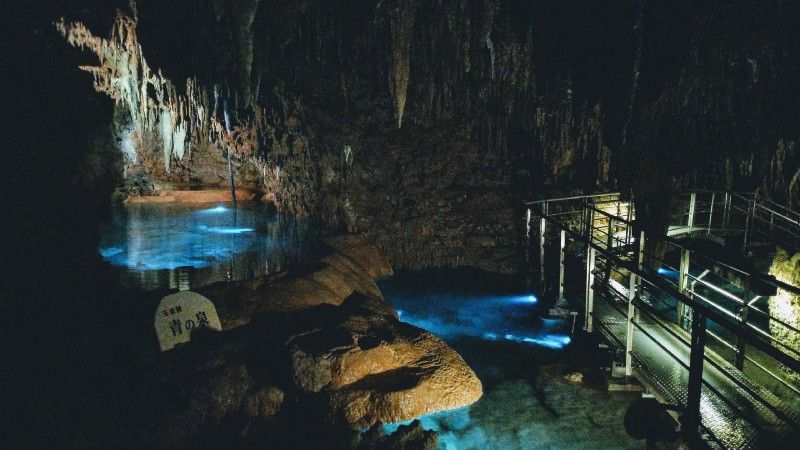
Yuquan Cave is the largest stalactite cave in Japan. Looking at the sightseeing map in the park, it seems that it is underground in the entire park, and the scale is spectacular. It will be fascinating to go in at first, but it takes less than five minutes to start to feel that the scenery is the same, and it takes about half an hour to forty minutes to walk through Yuquan Cave.
Perhaps because of this, the park will try to add a different atmosphere to the immutable stalactites in the way shown above. But I think the most beautiful place in the whole area is the place where you first started.
It is more interesting but unfortunately, we have found on the Internet that the park has a reservation system, so that tourists can leave the Yuquan Cave Trail and go deep into the cave under the guidance of a guide. It's a pity that it's only open for seven or eight months. This should be the only motive for us to come back to Kingdom Village.
other areas
Seeing how crazy I think this place is when I use a chapter to accommodate other areas.
Basically, other areas are play areas, and there are many experience activities with strong tourism meaning, such as making colored glass, blue dye, snake around the neck (doesn't understand how this experience point is related to Okinawa)... and so on, or watching the so-called Ryukyu original The dance of the inhabitants, like the Leofoo Village in Taiwan (whether it is really aboriginal or whether its dance is really traditional is another matter.)
Then there are various places that sell souvenirs and "local products", but you also know that the local products sold in such places usually don't look very delicious. If you really want to describe it, it's probably like tourists from other countries coming to Taiwan. Will rush to buy pineapple cakes in souvenir shops but look very unpalatable in the eyes of locals.
Keiza Cliff no Taki
Translation: Keiza Cliff Waterfall
Qingzu Cliff is located next to Qingzu Well and has underground agricultural water intake facilities. Qingzu Cliff Waterfall is an artificial waterfall formed by the height difference of the cliff at the outlet of the facility, and then directly connected to the intertidal beach full of reefs. There are many large and small waterfall pools washed away under the waterfall.
Because there are water collection facilities here, it is an official management place. It may be that there is no administrator due to lack of manpower or remote location. From the beginning of Shizi Road, there will be a notice saying that entry is prohibited. If you want to go under the waterfall and look up at the waterfall, you have to get down from the gravel road to the trail, and then you may have to leave the trail and walk on the reef for a while to get there (this part is not sure because we didn't continue walking).
Because only a small group of foreigners dared to climb over when we went, and the trail looked overgrown with grass because no one managed it, we gave up because it was a little dangerous to wear slippers, and just looked around for a little bit. Later, when I went home and saw on Google Map, there were locals who brought very young children to play, and some of them descended to the intertidal zone below. I am not sure how they got down. There may be reasonable paths that we did not find or know. For those who are interested in going, it is recommended to wear cloth shoes. The reefs do not seem to be easy to climb, so please pay attention to your own safety.
Peace Memorial Park
Peace Memorial Park is where the Battle of Okinawa Main Island ended in World War II. Due to the heavy casualties, the Okinawans set up such a park to guard against the horror of the war and the lost lives of future generations for the tragic lessons of the war.
The park is very big, we only walked a little in the area and did not enter the museum, so we can only briefly introduce it.
transportation
There is a parking lot in the park, but the locomotive grid is very inconspicuous, and it looks like a trough line from a distance. If you are going by motorcycle, be careful. At first we thought there was no locomotive grid and we went around a lot.
the foundation of peace
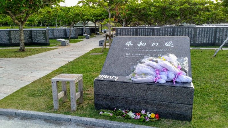
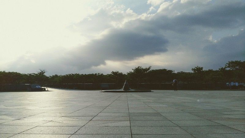
The foundation of peace is a fan-shaped area located in the park, close to the edge of the cliff. A pointed monument at the center of the fan-shaped circle and many black steles engraved with the names of the dead and wounded next to it show the heavy casualties of the war at that time. When I walked this road, my mood was actually very complicated. Seeing the flowers and letters that had just been placed on the monuments, it was really difficult to describe the current feeling in words.
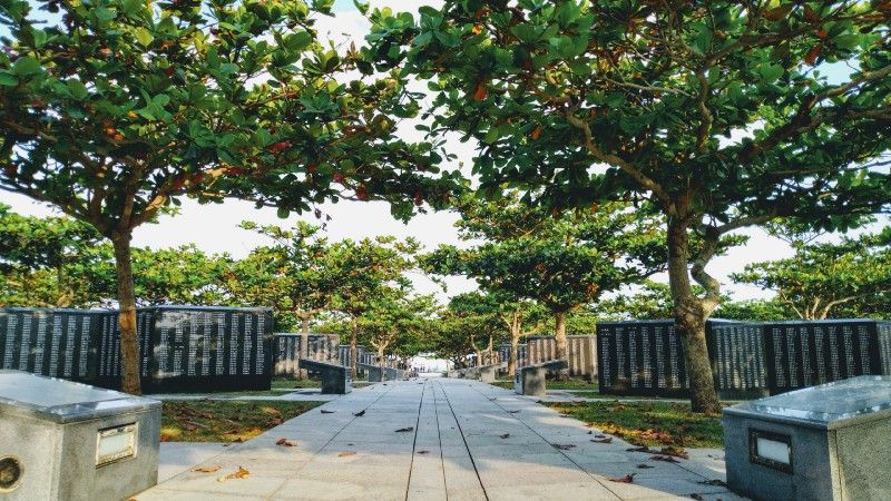
After passing through the black death and wounded monuments, you will come to the "Light of Peace". The Light of Peace on the edge of the cliff, because of its commanding heights, has a very magnificent sea view, but after walking through the section just now, I really don’t have the energy to appreciate it.
The second day I came to Okinawa, I spent it in the process of riding a motorcycle in a panic. I will write a detailed article about the transportation part after the article on the introduction of the attractions.
The southeastern part of Okinawa is a bit like Taiwan's northern coastline, with the sea on one side of the road and mountains on the other. Very comfortable to ride. Although there are relatively few famous scenic spots, all kinds of beach secrets, big and small, are worth exploring, and the scenic spots are also relatively primitive (except for Kingdom Village).
Before we set off, we booked a lot of pushpins on the map of this block. Although we all went to see it, the time was more compact than we thought, and we had to rush to the Outlet at the end, so all the attractions were taken with soy sauce. (Although most attractions can only be dipped in soy sauce).
The next footnote for the Southeast would be history and intertidal travel.
Like my work? Don't forget to support and clap, let me know that you are with me on the road of creation. Keep this enthusiasm together!

- Author
- More