Grand Circle Line | Travel through six national parks and make a loop in the Wild West
The Colorado Plateau is the best display of the scenery of the western United States. The endless wilderness, the road that stretches to the other side of the horizon, seems to be driving for days and nights without a trace of human beings. On the wasteland, vegetation grows sparsely, giant red sandstone is arbitrarily arranged, and the floods that flood in summer cut deep canyons, with a mysterious temperament like an alien planet. There are countless geological wonders in this area, which belong only to the aborigines who coexist with the redstone earth for a long time, and the adventurers who challenge the limits of nature.
When I talked about the national park system in the last article, I already mentioned the extreme lack of literary literacy of Americans in naming places. But in this magical land in the west, this ability is even more stretched. Facing the shocking and unspeakable geological wonders, after thinking about it, there is only one word "big" left. So the waterfall is called the Great Falls, the canyon is called the Grand Canyon, and The Grand Circle is undoubtedly the classic work of this naming system.
There are so many loop routes in the world, why is only this route named The Grand? How should the big loop be played?
This article will first introduce what the big loop is, and then share a route to play the big loop and daily highlights according to our itinerary. As for the more specific gameplay strategies for each national park, there will be more in the future! (Just dig a hole for yourself...) In the end, there will be some advanced gameplay, which may inspire you future great gods.
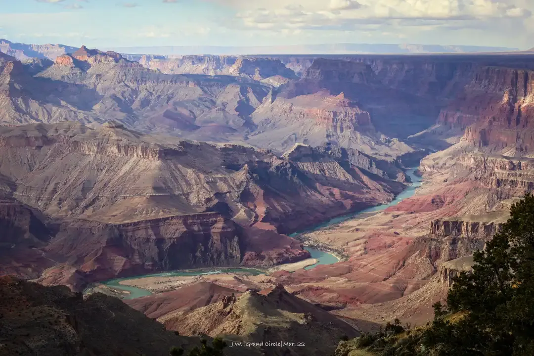
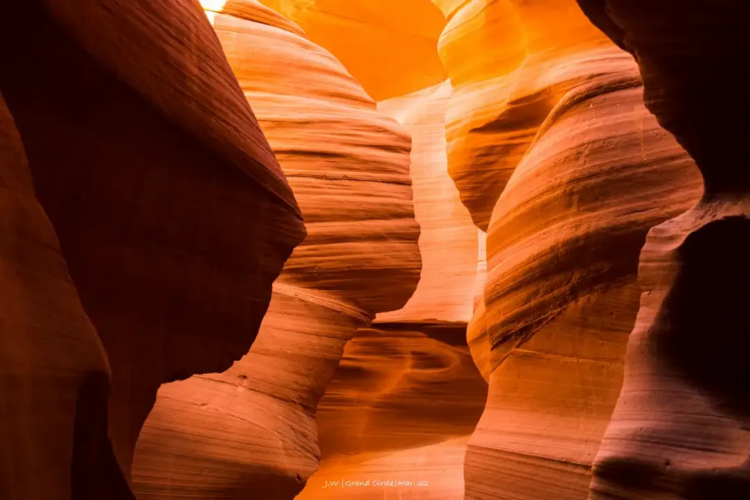
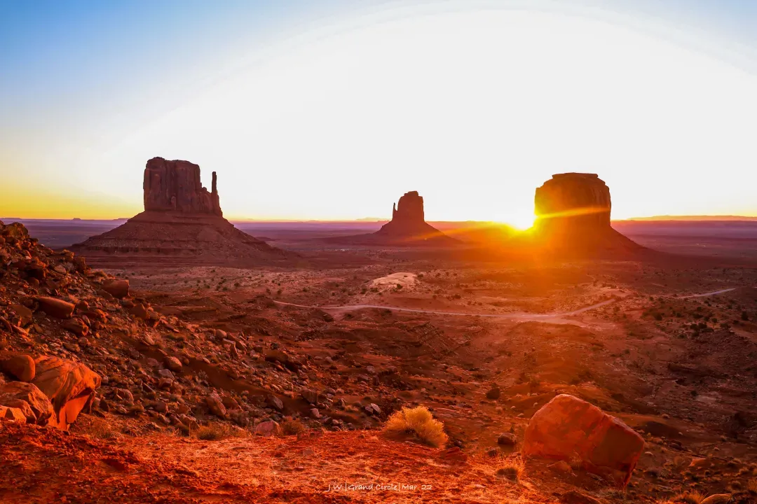
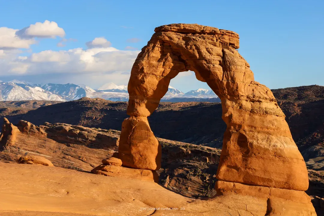
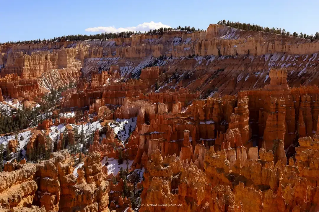
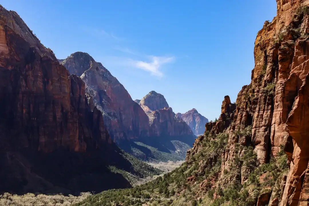
a big circle
The so-called big loop line is indeed a real circle:
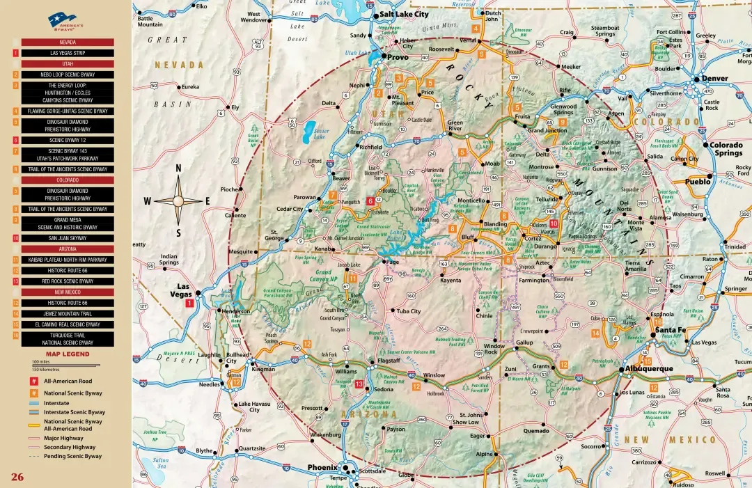
This area spans Arizona, Colorado, Nevada, New Mexico, and Utah, and includes 9 gorgeous national parks , N national monuments, national forests, national recreation areas, and a large Navajo reservation. , can be said to be a collection of the most essential natural wonders of the western United States.
Outside this big circle, the four big cities of Las Vegas, Phoenix, Denver, and Salt Lake City are divided into four corners. As the starting point of the itinerary, planes, rental cars and supplies can be connected. From any point, it is possible to design a non-circle. The itinerary of the road also makes this route so popular.
Based on this big loop, you can also go west to Death Valley and Southern California, northwest to Yosemite and the Bay Area, north through Salt Lake City to Yellowstone and Grand Teton, and east to the Rocky Mountains. The itinerary combination can be said Is ever-changing, rich and frugal by people.
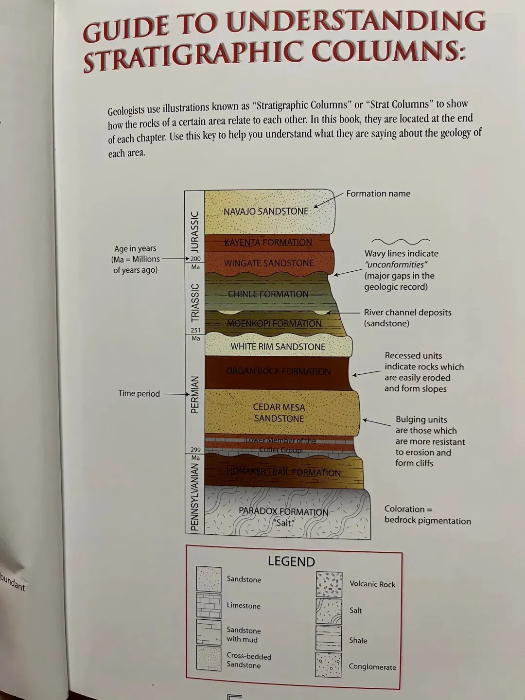
Geologically speaking, the Great Loop is dominated by the Colorado Plateau and encompasses a vast area that gradually transitions from the Rocky Mountains to the deserts of the west coast. The Colorado River and its tributaries run through it, cutting deep canyons and elaborate arches into the rock. It can be said that the power of water shaped the Great Loop .
The Northwest Arches, Canyonlands NP and Navajo Reservations are close to the Rocky Mountains, and the protagonist of the landscape is the red "Navajo Sandstone" . The area from Bryce Canyon to the Grand Canyon is unsurprisingly called the "Grand Staircase" without any aesthetics . The elevation continues to decline in the cycle of mesa-cliff, and the sedimentary layers of different periods are exposed in turn. On the surface , hundreds of millions of years of geological history are displayed intact.
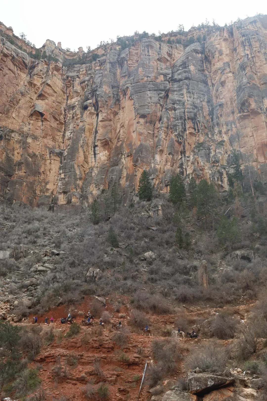
Because of this unique natural scenery, both geologists and ordinary tourists can find different surprises on the Great Ring Road. Coupled with the professional management of NPS, the Grand Circle Line is a very suitable destination for revisiting, and it will not be repeated many times. Americans are also well aware of the fun of the Grand Circle, and even created an NGO called the Grand Circle Association, whose purpose is to promote tourism on the Grand Circle ( https://www.grandcircle.org/ ), it is said that they engage in various NGOs There is really a set...
How to play the big loop
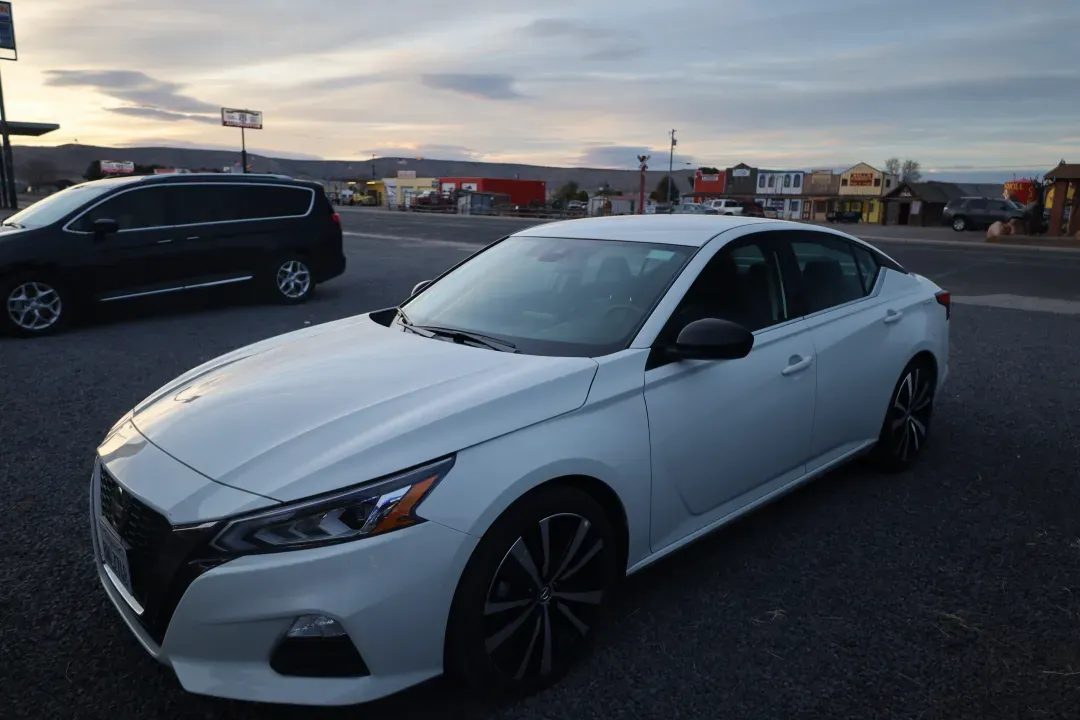
The Great Loop is vast and there are so many places worth visiting, even for a week-long spring break, you have to make a choice. This time we chose the most classic way, starting from Las Vegas and covering the essence of the Grand Circle in Arizona and Utah for 7 full days, and the whole journey is about 1250 miles . Walking down feels moderate driving time every day, and each national park can choose 1-2 more popular trails . If you want to be more relaxed, this route is more suitable for 7-9 days , 6 days is also possible, but it must be open at night.
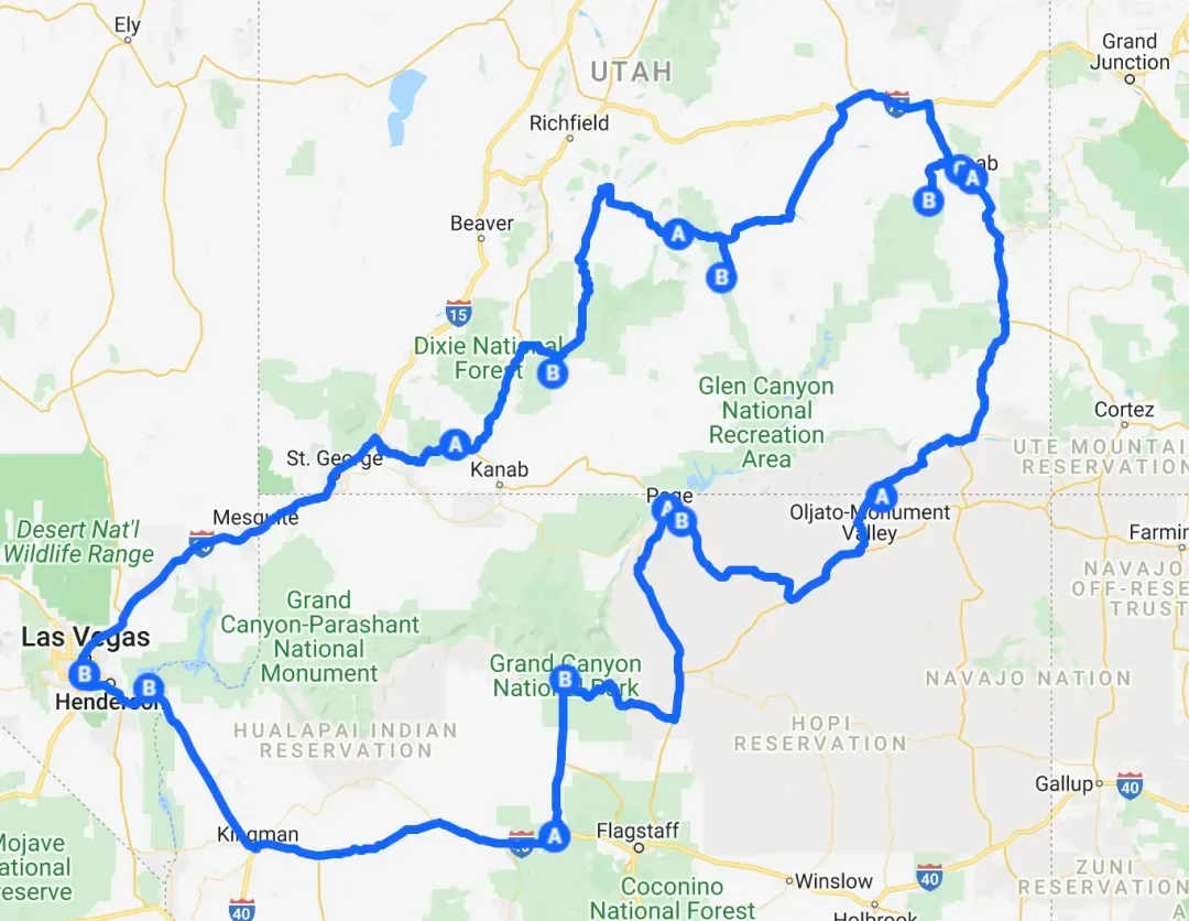
Here are the things I'd love to do, but just can't fit into this short itinerary, each requiring an extra 2-3 days : 1. Go deep into the hidden corners of any national park (that's too much, Such as the North Rim of the Grand Canyon, The Needles in the canyon, the upstream of Zion, etc.); 2. Go to the Navajo Reservation to see the ruins of aboriginal settlements ; 3. Go around the Rocky Mountains of Colorado. Of course, many of these hardcore experiences can only be performed in the summer, and the time of spring break can be regarded as helping me put an end to the difficulty of choosing.
When it comes to seasons, the Great Ring Road is suitable for all seasons. The advantage of summer is that all places will be fully open, but at the same time, we must also face various current restrictions in national parks in the peak season and high temperatures of 40 degrees at every turn; short daylight hours in winter. , There are many closed roads, and walking is the most inconvenient , but there are few people and quiet. As for the two seasons of spring and autumn, it is natural that each has its own strengths when luck is good, and two evils superimpose when luck is bad... Therefore, you must carefully check the opening arrangements of various national parks before traveling. Guess how lucky we were this time?
Next, I will list the approximate route and daily highlights according to the daily itinerary, and I will also mark the places I think I can spend more time exploring in depth. Since the following is a counterclockwise route to the Grand Canyon first, if you want to go clockwise to Zion first, just turn your phone upside down and look at it. Due to the ever-changing combination of routes of the Great Ring Road, you can completely change according to your own schedule and preferences.
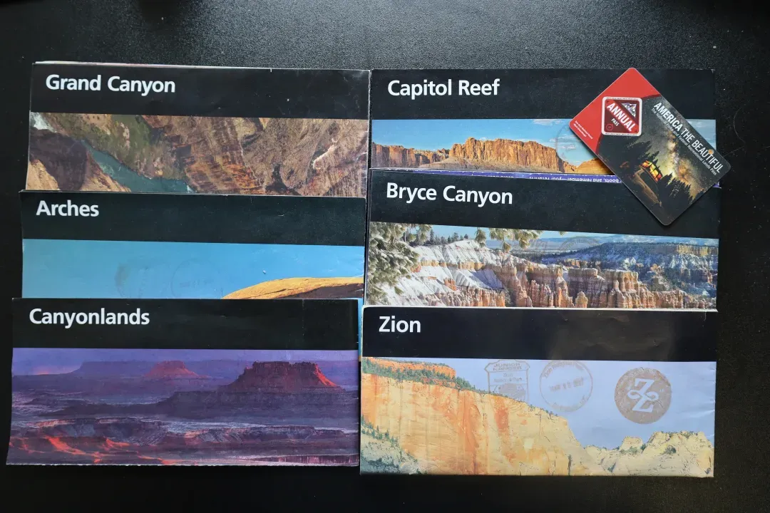
Day1: Start the road trip
Depart from Las Vegas. Due to the distance and the consideration of earning back the travel expenses in the casino, Las Vegas is the most popular distribution center for tourism on the Grand Circle Line, and it takes about 3 hours to drive from Salt Lake City or Phoenix City.
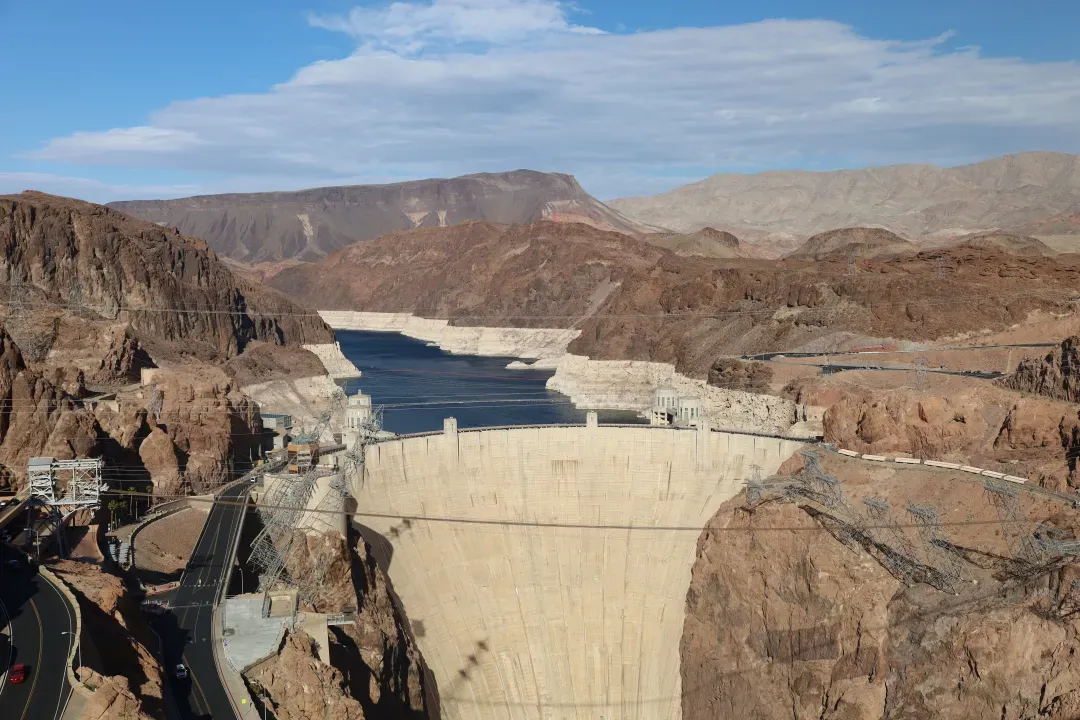
After half an hour, you can get off the highway and enter the Hoover Dam . As an economics student, this is a check-in point where textbooks can be brought into life. Wow! The dam cuts off the Colorado River to form the Mead Lake National Recreation Area (Mead Lake NRA) , a great place for Nevada residents to enjoy water activities. The dam has a guided tour inside, so if you don't participate, you can see it from afar.
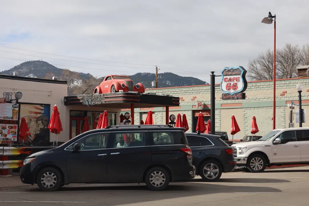
Get back on the highway, cross the river and into Arizona, and the classic Route 66 is right in front of you. Kingman is the first town to pass through on this lonely highway that once held the American Dream, and friends from Southern California will also enter the city from here after crossing the Joshua Tree NP. loop. Further ahead are the small towns of Seligman and Williams . These towns have lost their function as transportation hubs, but in decline they appear more western. Williams Street is especially cool.
For the night, consider staying in Williams, or drive another 50 minutes to the small town of Tusayan on the edge of the Grand Canyon.
Today's mileage: ~200 miles, about 3 hours.

Day2: Deep into the Grand Canyon
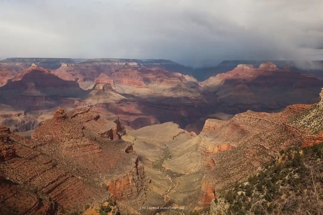
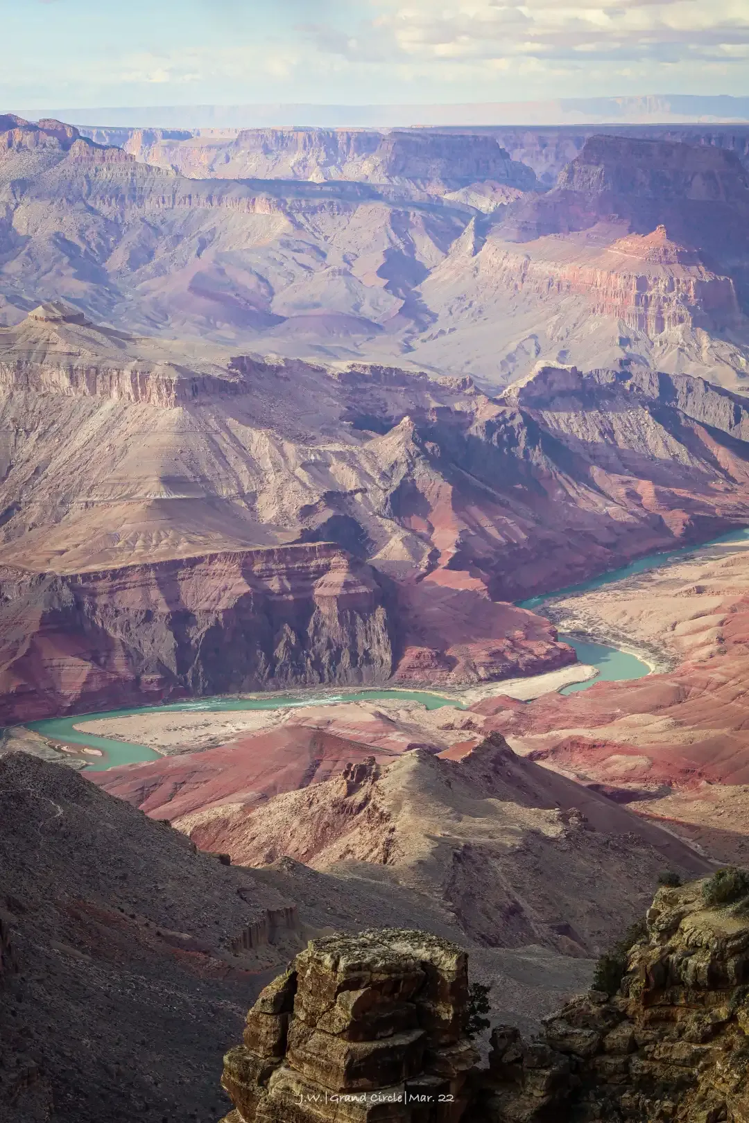
Head straight into the Grand Canyon NP South Rim in the morning. This is the last national park cut out of the Colorado River system, and one of the most prestigious. The turbulent Colorado River runs day and night, cutting out a 1,500-meter-deep canyon, exposing the various rock formations buried deep in the ground to the air, forming towering and layered cliffs on both sides. Looking down the rock wall, it is like walking through the geological history of billions of years, and the magnificence and power of the earth can be seen at a glance.
South Rim's gameplay is simple. Highway AZ-64 traverses the platform on the top of the cliff, and a series of viewing platforms extend from the roadside, overlooking the canyon landscape. Several famous walks start from the viewing platform and zigzag down the cliffs all the way down to the valley at the bottom. It takes a full day to walk to the river and camp on the bottom of the valley.
Due to the high number of tourists, the Grand Canyon operates a shuttle bus system almost year-round, and many viewpoints are closed to private vehicles. The Grand Canyon Village at the center of the park has hotels, restaurants and campgrounds. In spring, summer and autumn, you can also leave the park from Desert View on the east side of the national park and go to the Peggy accommodation.
Today's mileage: ~200 miles, about 3 hours.
Day3: Light and shadow of Antelope Valley
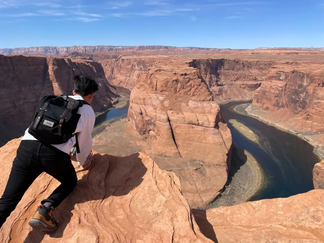
The small town of Page is located in the center of the Great Ring Road. It is the only place to go to the Grand Canyon in the south and the Monument Valley in the north. If time is tight, you can go directly west to Zion here and take a small ring line. The town itself is also an important stop on the Great Circle Line, and the nearby Antelope Canyon and Horseshoe Bend are not to be missed.
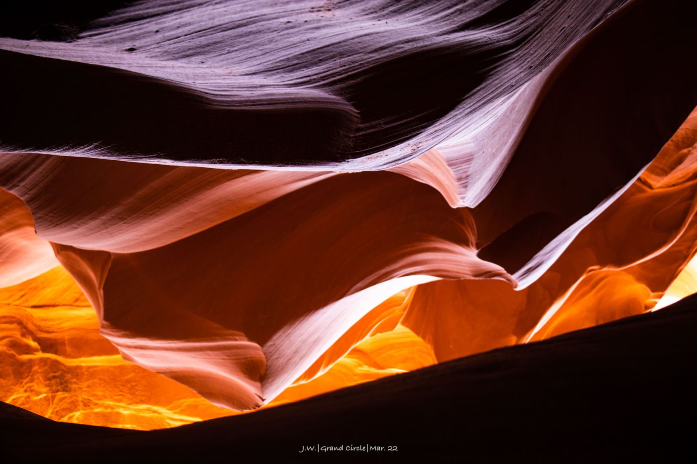
Antelope Canyon is a slot canyon . The flowing water has eroded deep and narrow channels and carved delicate lines on the rock walls. The sun shines through the slits, forming strange and changing light and shadow. There are not only two similar canyons in the Antelope Valley near Page, but they are all Navajo reservations and are not under the jurisdiction of NPS. Tickets are more expensive than the other, and you often have to find scalpers to buy them... As for Horseshoe Bay, it is A 180-degree turn out of the Colorado River, easy to reach, the scenery is very photogenic, so it is also a must-see for Page. Las Vegas has a tour group to and from these two attractions on the same day (6 hours one-way drive, if you are not deeply in love with Antelope Valley, you should drive by yourself...).
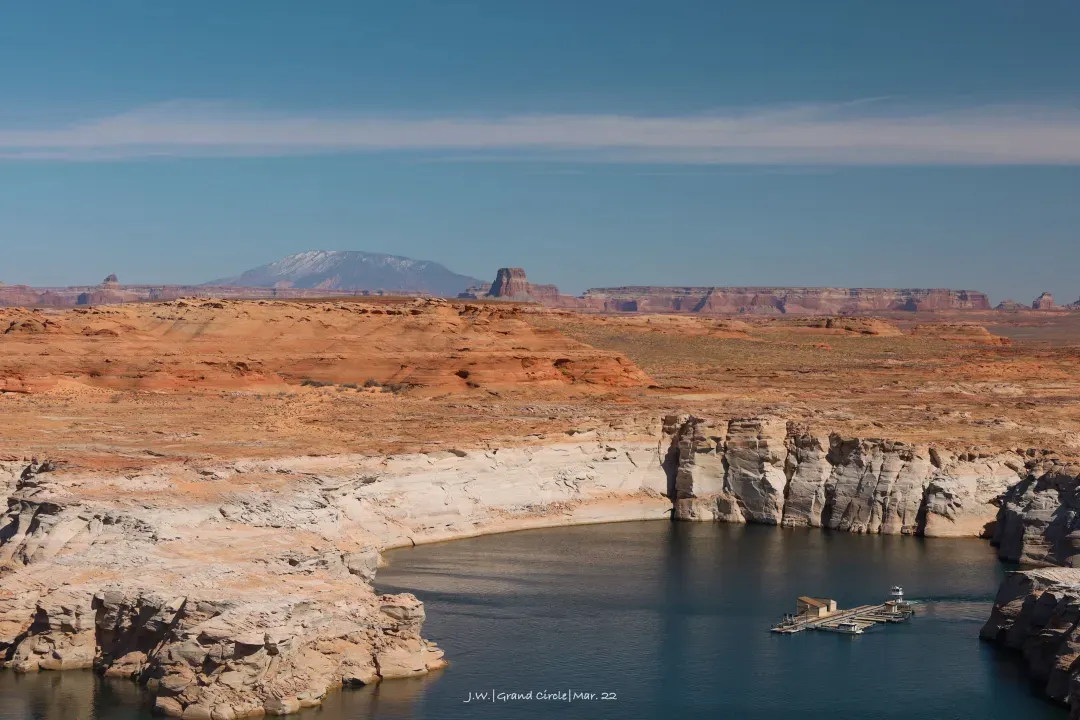
Often overlooked is the Glen Canyon NRA , the only nearby National Park annual pass. The area is dominated by the Glen Canyon Dam and the Lake Powell that it blocks, and contains a large area of relatively uninhabited areas, which can be accessed by boat to the fjords, rocks and arches deep in Lake Powell . Such as the world's largest natural arch Rainbow Bridge (Rainbow Bridge NM) can only be reached by boat when the reservoir water level is high.
If you have enough time, it is recommended to stay in Peggy for a day or two. If you go to Monument Valley on the same day as we did, you need to reserve a two-hour drive. And this section of the road has excellent scenery, it is recommended to leave a lot of time for parking and taking pictures.
Today's mileage: ~130 miles, about 2 hours.
Day4: Morning and dusk in Monument Valley
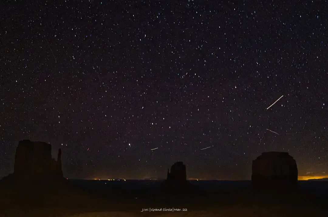
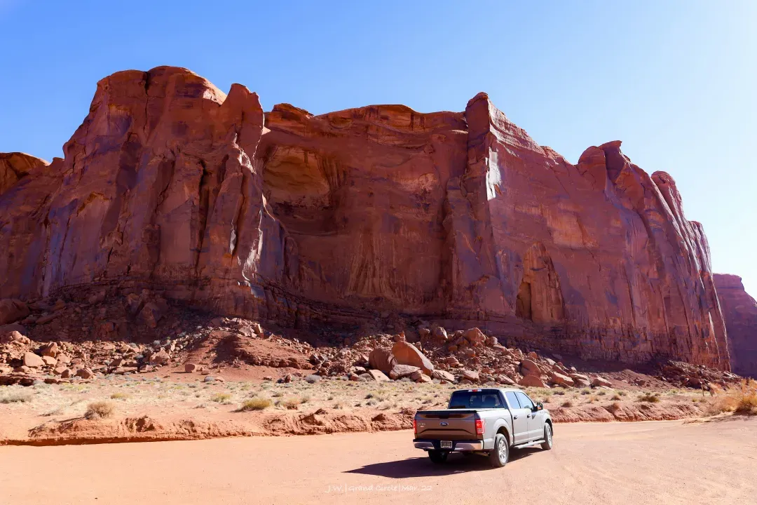
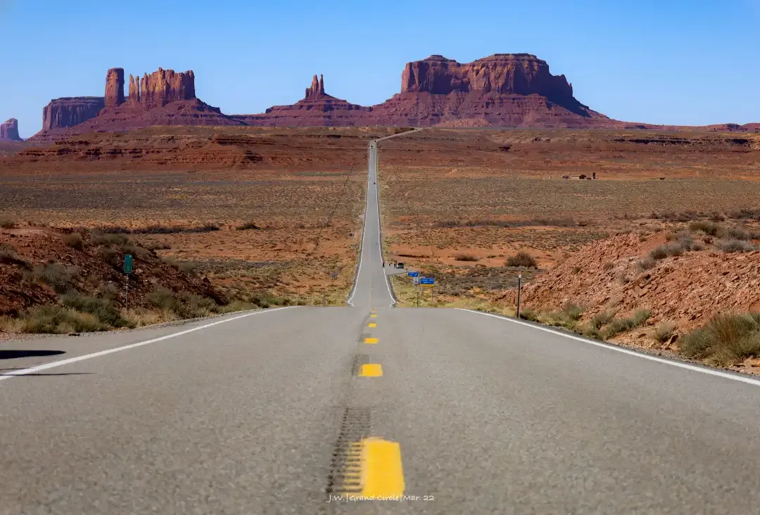
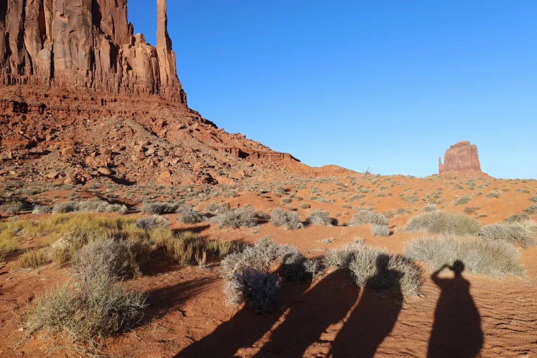
The Monument Valley Navajo Tribal Park , on the border between Arizona and Utah, is perhaps the most western part of the Great Circle. The boundless wasteland and the straight road, the wind in the wilderness rolled up the sand and dust. In the center of the horizon, several brown-red lone peaks rise from the ground, overlooking the earth with a solemn attitude. When the aborigines wandered and migrated here, how could they not regard these pinnacles as miracles?
Because it is an Aboriginal reservation, the park is not governed by the NPS, and there is a $25 fee per vehicle to enter the 17-mile-long scenic loop, and guided tours are required to enter the larger area still inhabited by Aboriginal people.
The vicinity of Monument Valley is deserted, except for a hotel with a view and a few camps. But in the wilderness with no light pollution at all, there is a night sky that is absolutely beyond imagination , and it is here that I understand that the word "Galaxy" is so realistic. If you watched the stars the night before, the day's drive was more comfortable; if you came from Page in the morning, you would have to drive another 2.5 hours to Moab after watching Monument Valley.
Today's mileage: ~160 miles, about 2.5 hours.
Day5: Arches and deep valleys
Officially entering the boundaries of Utah, the Grand Circle Line cannot bypass Utah's proud "Mighty 5" -- 5 national parks. First of all, guarding both sides of the small town Moab (Moab) , are the two national parks , Arches NP and Canyonlands NP .
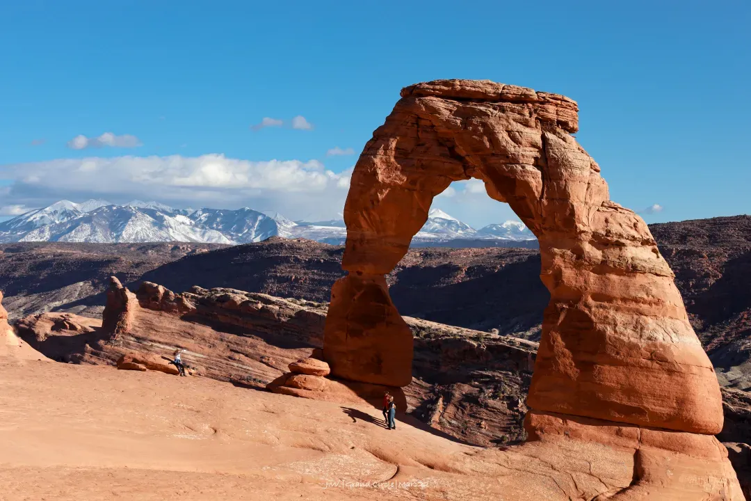
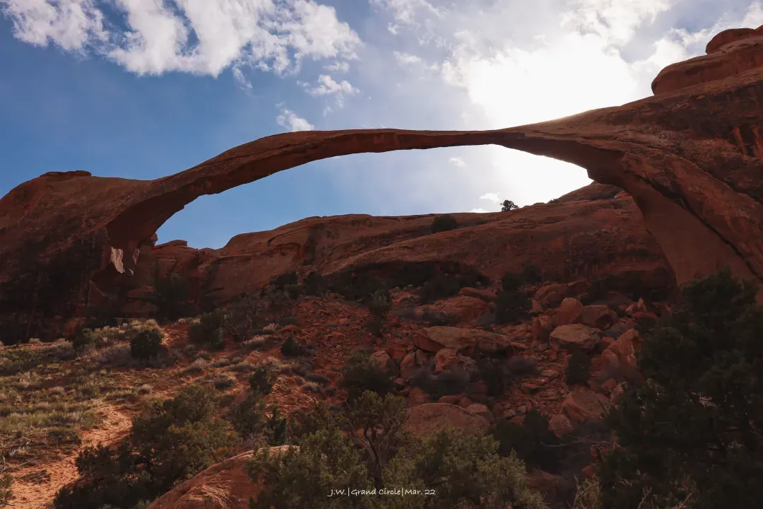
Arches National Park is an area with extremely high density of natural stone arches. The sandstone and cracks that have been twisted in the geological movement have been eroded by running water over the years, creating more than 2,000 stone arches in the park. There is only one main road in the park, and the map is very clear. When you get to a place, just get off the car and look for the arch! The actual size of these arches is much larger than it appears in the photos, and after climbing several hills, the shock of seeing them in person is difficult to describe in words.
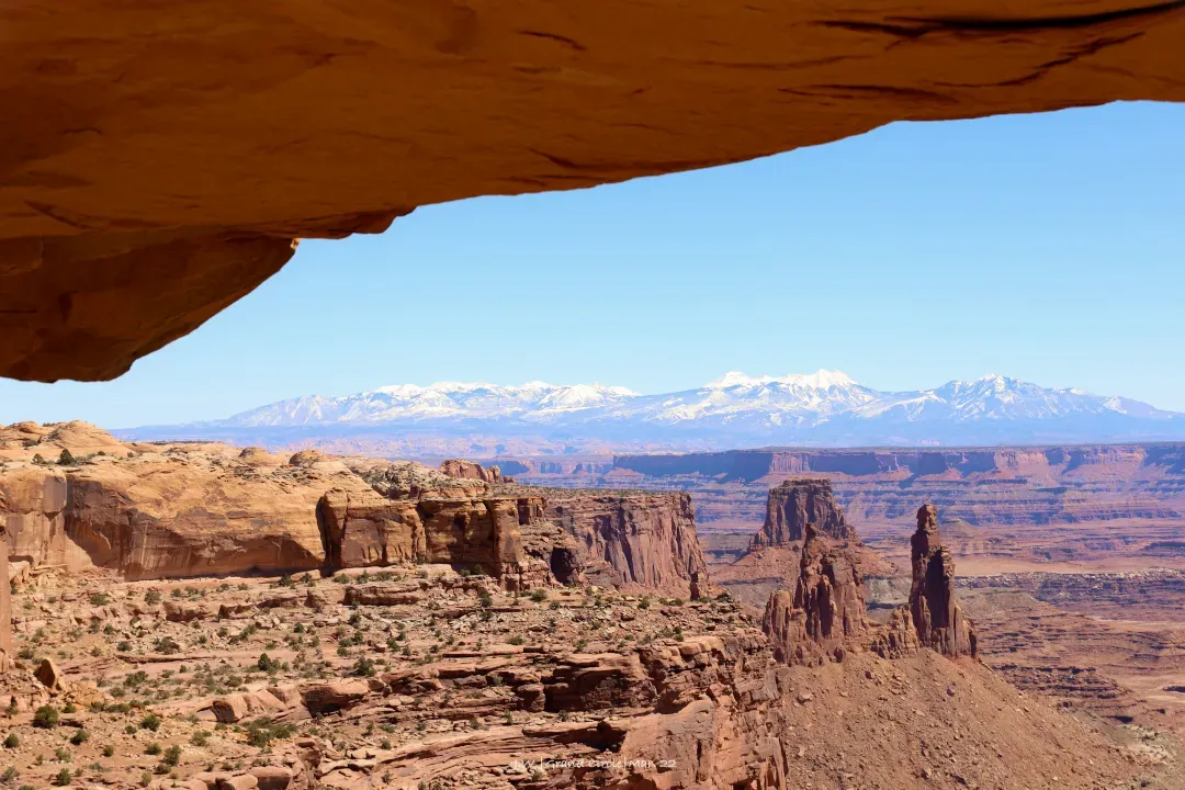
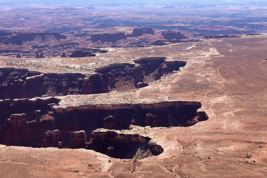
Interestingly, Canyonlands National Park's most famous feature is also an arch... The Mesa Arch is a classic view of the sunrise. But in fact, Canyonlands is a national park designed for hardcore players. The winding canyons eroded by the Colorado River and the Green River hide countless off-road vehicles, and the Grand Circle area and even the entire continental United States are remote secrets. You can also feel the majesty of the canyon from the high viewing platform, but perhaps only through this large no-man's land can you feel its full energy.
If not off-roading, arches and canyons can be arranged in one day (off-road enthusiasts can stay here all week). The road to Capitol Reef is pretty deserted, we live in the small town of Torrey, the other option is to drive another 1-2 hours to other towns on UT-12.
Today's mileage: ~150 miles, about 2.5 hours.
Day6: One-day Geography Class Experience
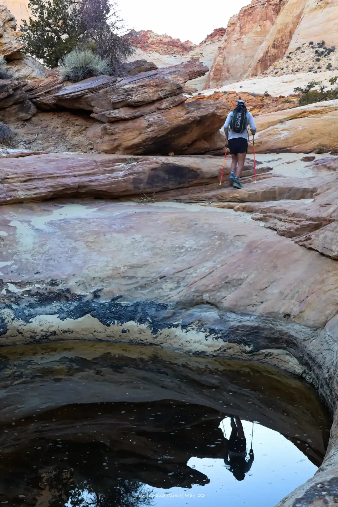
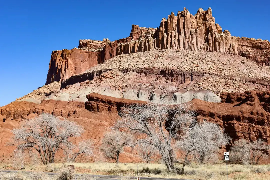
Capitol Reef NP can be said to be the most unpopular national park in the Grand Ring, and many people skip it when they are on their way. The park protects the Waterpocket Fold , a rugged barrier formed by the uplift and erosion of the plateau. But the park's unique water pocket erosion looks like a stinky puddle when photographed, while other geological formations are either hidden in four-wheel-drive access or can only be felt from the air. In terms of places where ordinary tourists arrive, the visual impact is indeed not comparable to other parks.
But I have to make a name for it! Although the probability of a large film is lower, the trails on the Dome Reef are few and quiet. Walking through the deep valley with no one, watching the aboriginal murals and honeycomb-shaped smooth holes on the rock walls on both sides, you can fully immerse yourself in the feeling of nature. Deep and mysterious.
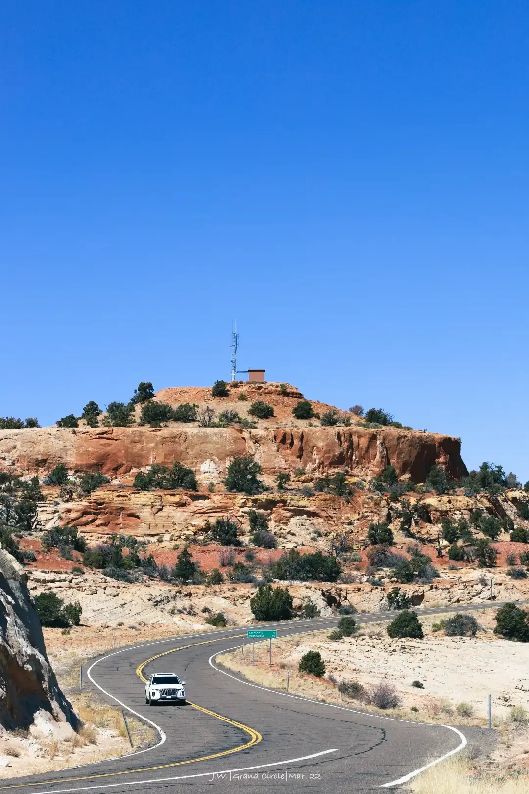
Leave Capitol Reef and take Utah Route 12 (UT-12) , which is called the most beautiful scenic highway in the United States, and descends continuously through the entire "Grand Staircase". At the beginning, there are snow-capped mountains, then green coniferous forests, to hot and barren rocky deserts, and then to lush green canyons and streams... A road trip is like taking a real-life geography class, turning a corner, New landscapes emerge like flipping through textbooks. If you are in a hurry, you must discuss the number of stops with the driver, otherwise you may not finish the day.
The end of UT-12 is Bryce Canyon. We arrived earlier and went directly into the canyon to visit. There are some small towns and ranches nearby where you can stay.
Today's mileage: ~130 miles of mountain road, about 2.5 hours.
Day7: Ultimate Mountaineering Training
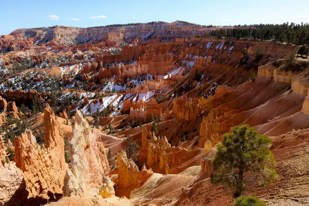
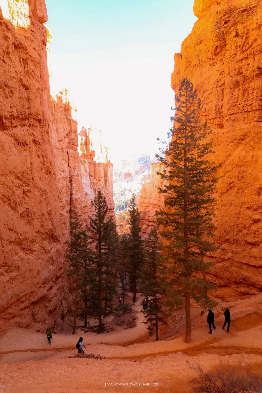
Bryce Canyon NP has a bland name, but it's much clearer to say it's "Stone Forest". This national park displays a large red rock column, known to the Aboriginal people as Hoodoos. Any such peculiarly shaped stone will be given some far-fetched names. Bryce Canyon also has a window of the world landscape award from "Wall Street", "Queen's Head" to "Thor's Hammer". The scenery of each viewing platform is similar, but if you walk into the canyon, you can change the angle and experience the grandeur of this stone formation.
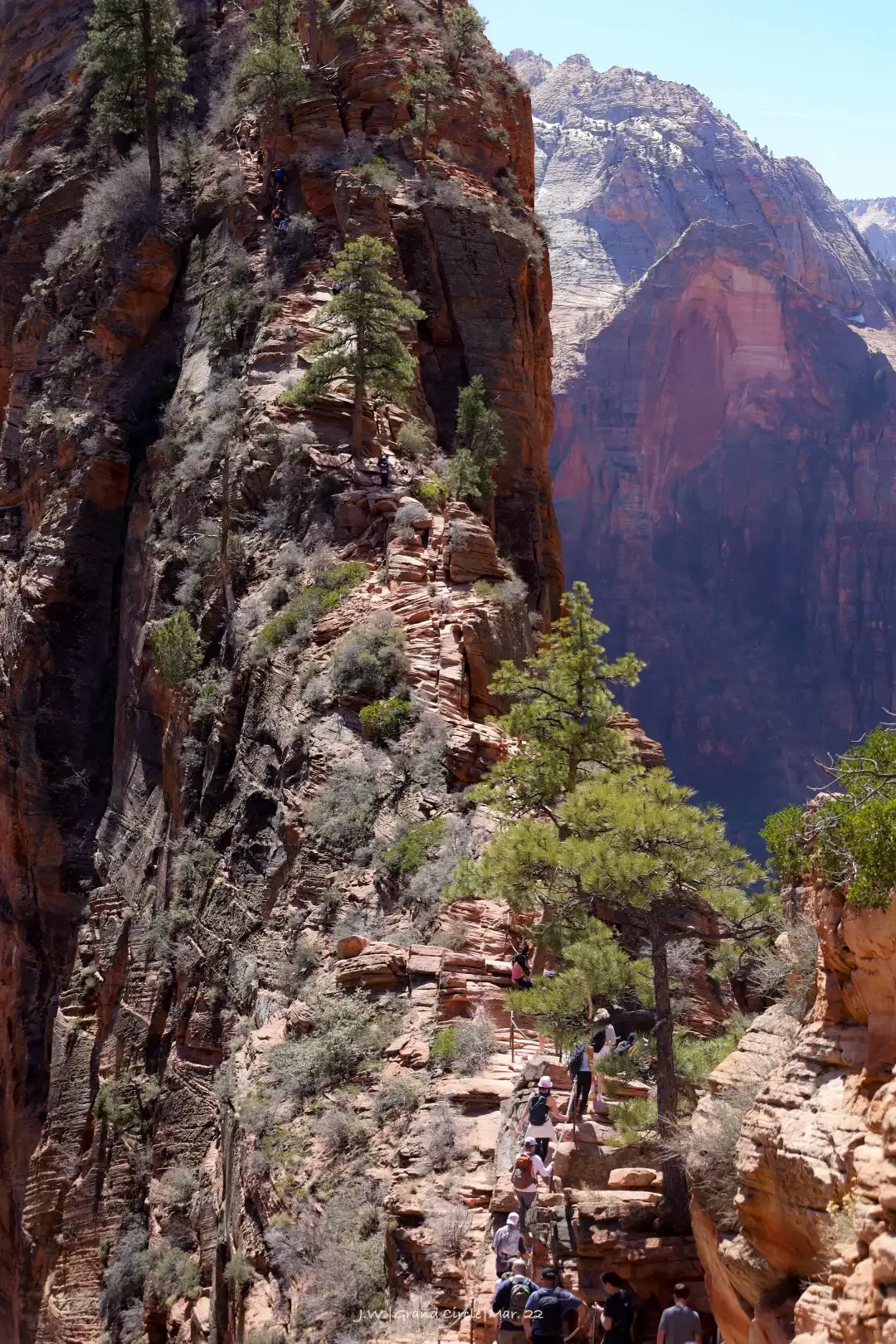
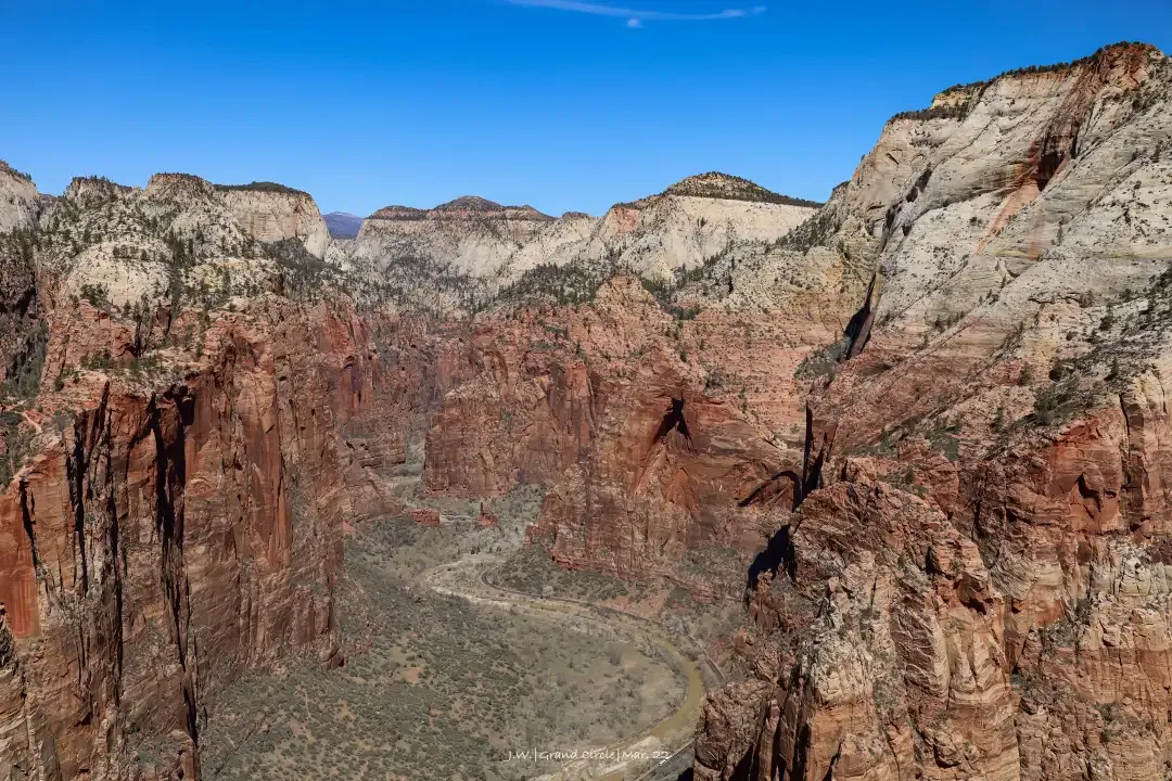
As the Grand Circle Line is about to complete a lap, it will come to the last national park, Zion (Zion NP) , which is only 3 hours away from Las Vegas. The scenery here is naturally very impressive (or you would not dare to touch Jerusalem), the Virgin River (Virgin River) cuts out the Zion Canyon, the cliffs are steep, the valley is deep and long, and the iconic red rock makes the canyon look gorgeous. Zion's hiking experience is very rich, from climbing mountains with iron chains to climbing rivers with water shoes, so it is deeply loved by the old beauty who loves to die. Last year, the number of tourists received surpassed Yellowstone and the Grand Canyon. In the face of such a turbulent passenger flow, NPS has used all the tricks from shuttle bus to peak season reservation to trail lottery.
From Zion, you can go straight to Las Vegas. After a week of speeding in the wilderness of the Great Ring Road, I finally arrived at the man-made big city, and maybe I still feel a little uncomfortable. Las Vegas buffets and big hotels are artifacts of recuperation; and if you still have energy, there is another struggle waiting for you here!
Today's mileage: ~200 miles, about 3 hours.
Advanced gameplay
Of course, the above routes are more suitable for novice road trips like us who are playing the big loop for the first time, but can't spare ten days and a half months. If you have the self-confidence and strength of the Great God, there are countless advanced gameplays on the Great Ring Line:
In the Arizona section, Kanab , a small town at the junction of the two states, is the lottery base for various nearby secret places with strict current restrictions. Buttes North). In the Grand Canyon, there are the red rock town of Sedona (Sedona), the chocolate-colored waterfall on the Little Colorado River, and the various waterfalls and rocks that can only be reached by camping in the Indian reservation west of the national park. ...
The Great Ring Road in the Utah section is even more crouching tiger, hidden dragon, The Needles and The Maze area of Canyonlands National Park (you know how difficult it is to hear the name), the boulders and grand steps in the Cathedral Valley of Dome Reef National Park - The slot canyons of Grand Staircase-Escalante NM , as well as the various landforms on both sides of Lake Powell, are a destination for highly skilled, physically active and experienced off-roaders .
Not to mention the four-state junction area that was missed this time, as well as the New Mexico and Colorado sections of the Great Circle Line further east. The Canyon de Chelly NM and Mesa Verde NP in the Navajo Reservation are ancient human civilization sites on the western land, and the Rocky Mountains allow people to switch from desert to forest in an instant. It makes you feel compelled to go.
Writing down these places, not only does this article have 5,000 words, but it also makes me see the potential of writing three to five or seven 5,000 words for them in the future... This will be reserved for the next big loop trip (God knows what it is) time). So if you silently put the Great Loop on your US list after reading this long post, then be sure to send me a tip photo, especially where I haven't been.
But how wonderful the Great Ring Road and Westworld can be in 5,000 words? Drive your little car, see you on the big ring road!
Like my work? Don't forget to support and clap, let me know that you are with me on the road of creation. Keep this enthusiasm together!
