Star Small Bookcase
A few years ago, mountaineering coach D sent an invitation to everyone in a small chat:
"Are you interested in taking a trip to the Batongguan Ancient Road? It's not for the purpose of climbing to the top, it's purely a tour of the ancient road, and it can also enhance the ability of map interpretation!"
What is the "Eight Passes the Ancient Road"?
In 1875, Wu Guangliang, the commander-in-chief of the Qing Dynasty, led the Flying Tiger Army and opened up a cross-road from Zhushan in Nantou, through Dongpu and Batongguan, to Yuli in Hualien. .
In 1914, during the Japanese rule of Taiwan, there was a strong conflict with the Bunun people due to the way of governance. In order to monitor or encircle the Bunun people, the ancient road of the Eight Passes was rebuilt and the residence of the Japanese police was increased.
With the surrender of the last Bunun people in 1933, the station was gradually abandoned, and today it has been transformed into a vertical route of high mountains.
This is a 100-kilometer-long alpine vertical walking trail. It takes six to eight days to walk in heavy equipment. It is not as weak as I have the means to look up, and I can only give up the invitation of the coach.
In December 2021, a few years after this invitation, I accidentally met " Yue Ling Ji ".
The author, Mr. Wang Weizhi, graduated from the Chinese Department of National Taiwan University. He has written many books and won the Hualien Cultural Heritage Award in 2021. He has lived in Hualien for many years and loves mountaineering. He is good at showing the local culture of mountains and forests with his beautiful writing ability.
At first, I was attracted by the propaganda of this book.
Walking into the Batongguan Crossing Road, the whole process does not attack the top of the mountain, but it is easy to be called by time, and hear the stories of people who came and went on this old road that climbed and descended along the contour line.
This paragraph seems to be the feeling that the coach's eyes lit up and told us, and it turned into a book on paper. I can't help but open it, with a feeling of reverence and worship, relaxed but not frivolous, looking forward to imagining that I can take a trip to the eight customs clearance.
However, with the progress of reading, the relaxed mood gradually left, replaced by sentimentality and regret. I originally thought this was just a book related to mountaineering, but unexpectedly, I visited the history of the Bunun along with the book. After closing the book, I immediately downloaded the track GPX of the ancient road of the Eight Passes, matched it with the contour map, and started the journey again.
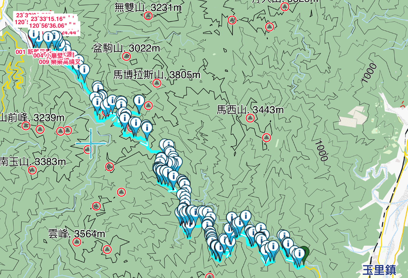
The author enters from the east to the west , and from the low altitude to the high altitude , the difficulty is not known how many times higher than the west to the east.
From the mountain entrance (about 450M above sea level) to the Jiaxin Station (about 4.5 kilometers away, 793M above sea level), it is quite approachable. However, the author has walked this section many times, and has doubts about the sound that Jiaxin has heard near the place where Jiaxin resides: "It is not the sound of the forest. " Finally had a chance to let him find the possible trajectory and find the source of the sound.
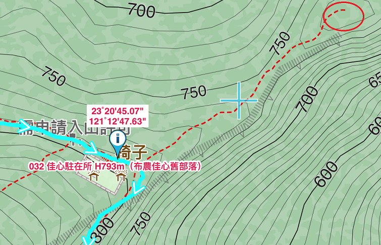
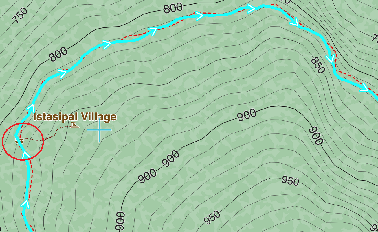
It is " KSS-748 ". A reconstruction of a Bunun family house with uncertain roots, uncertain original appearance, and even uncertain original construction methods. In other words, when the author saw it, the reconstruction may not have been completed, because the covering of the slate roof is not tight enough, and it must be covered with blue and white canvas to prevent water leakage.
Uninhabited houses are bound to be destroyed, so I have the same doubts as the author, is it really necessary to rebuild uninhabited houses?
Put down your doubts about KSS-748 and move on, and soon you will encounter the classic blocking stone " Great White Shark " (about 1.5 kilometers away from the previous section, about 820M above sea level).
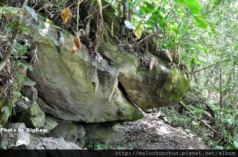
The scene described by the author is too cute. I couldn't help but search the Internet for the appearance of the great white shark stone, and it really resembles the Q version of the great white shark.
Carefully stick to the stone, after drilling through the great white shark, and passing by the jute station, you will encounter the "Monument of the Dead in Kasiphanan " built by the Japanese police and the Bunun people on the first day of the trip due to the bloody conflict (the same as the previous paragraph). The distance is about 2.5 kilometers, and the altitude is about 905M).
The incident took place on May 12, 1915, when the Bunun people launched a surprise attack on the Kasiphanan station. The Japanese police suffered heavy casualties. The station was abandoned after half a year due to arson. Since there is no real detailed record of this event, the author provides some conjectures and conjectures, so that people can easily imagine the situation at that time. This is the resistance of the Bunun people, but the Japanese police stationed there may also be innocent. It is difficult to judge who is right in the torrent of history, and can only follow the words in the book, comprehend and remember.
After paying tribute to the monument, the next stop is " Walami Mountain House " (about 4.8KM from the previous section, 1073M above sea level).
Where did the name of Warami come from? There are currently two theories. One is the Bunun and Malavi (come together), and the other is the Japanese name Warabi (fern) of the residence. The language "transliteration" is the name of the residence.
Regardless of its origins, Varami is a coveted mountain wilderness.
After leaving Varami, due to the rain and the dark sky, the author and his party camped at the old site of "Shanyin Station " (about 5.9KM from the previous section, about 1640M above sea level).
At present, there is only one canvas roof left, but there are water pipes to supply water, so it is called " canvas camp ".
Although the residence no longer exists, it belongs to the middle-level mountain height and is a mountain valley, and the thick humidity is definitely a local specialty. The author, who barely survived the night, couldn't help but sympathize with the Japanese police who were stationed here.
The next day was fine and sunny, followed the author's footsteps and headed to the " Thirteen Mile Residence" (about 14.6KM from the previous section, about 1801M above sea level).
The reason why it is called so beautiful is that in addition to the Japanese original sound of Shisanli being Tomiri, there has been a rare fountain in the mountains and forests, which may also be one of the original sounds, even if the reason for the existence of this residence is not beautiful at all.
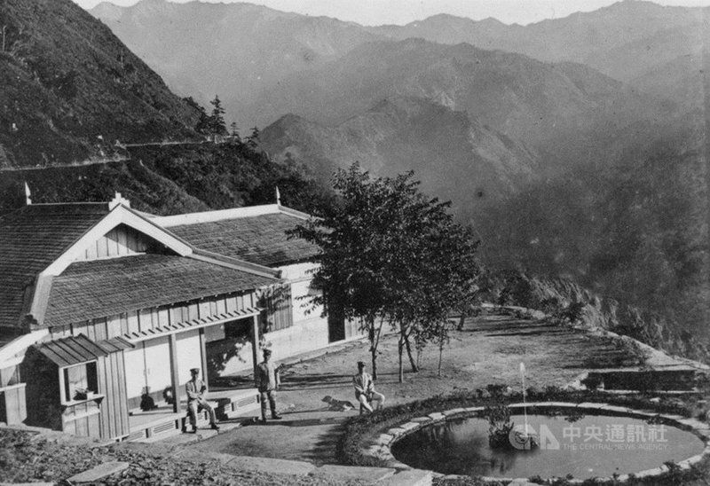
At that time, such a fountain was dug deep in the mountains, and water was diverted to make it " spray ". The author explained exactly how difficult it was. I found this original photo on the Internet, and with the author's textual imaginings full of sense of presence, time is indeed condensed in the photo.
Today, there are only remnants of the walls and tiles left at the Shisanli Station, and most people still only remember the inaccurate name "How Beautiful".
Leaving Shisanli, the next stop is " Oita Mountain House " (about 5.7KM from the previous section, 1296M above sea level).
Reloading and going down steeply has always been more difficult than going up steeply. Anyone who has had the same experience can understand it. The altitude of Oita is 500 meters lower than Shisanli, and the taste of it is that the calf is sore just by imagining it.
The Oita Mountain House is right next to the site of the Oita Station, which was destroyed by the " Oita Incident " in 1915. Therefore, the Japanese police withdrew from the station, and after a few years of calm, they made a comeback.
In the same year, one of the three most well-known anti-Japanese leaders, "Laho Ale", led some of the tribe to leave the homeland of "Tamaho" and no longer participated in the anti-Japanese affairs. Three different endings. Following the author's explanation, while my heart skipped a beat, I tried to understand the mood and feelings of the Bunun people under the three leaders at that time. Finally couldn't help but search for La Jolla's story, ah! Fortunately, there is a happy ending!
The next day after arriving at the Oita Mountain House, the author visited the " Huabano Station" (about 4.3 kilometers one way with Oita, with a height difference of 633M, a simple side mission).
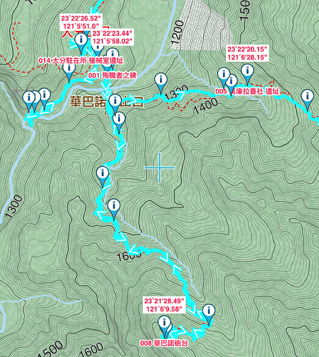
This trip has to be a special trip, and it is not an easy tour. Maybe because of space constraints, the author did not write too much, so he got up again the next day and went in the direction of Tu Ge.
About 1.5 kilometers away, you will arrive at the site of the "Lagula Station" (about 1384M above sea level). Although the height difference is less than 100 meters, the terrain is not easy to go up and down. It is really satisfying to read the author's understatement. envious. On the way, I will also pass the beautiful "Oita Falls". The word "beautiful" is the definition given by the author. I searched for real photos again.
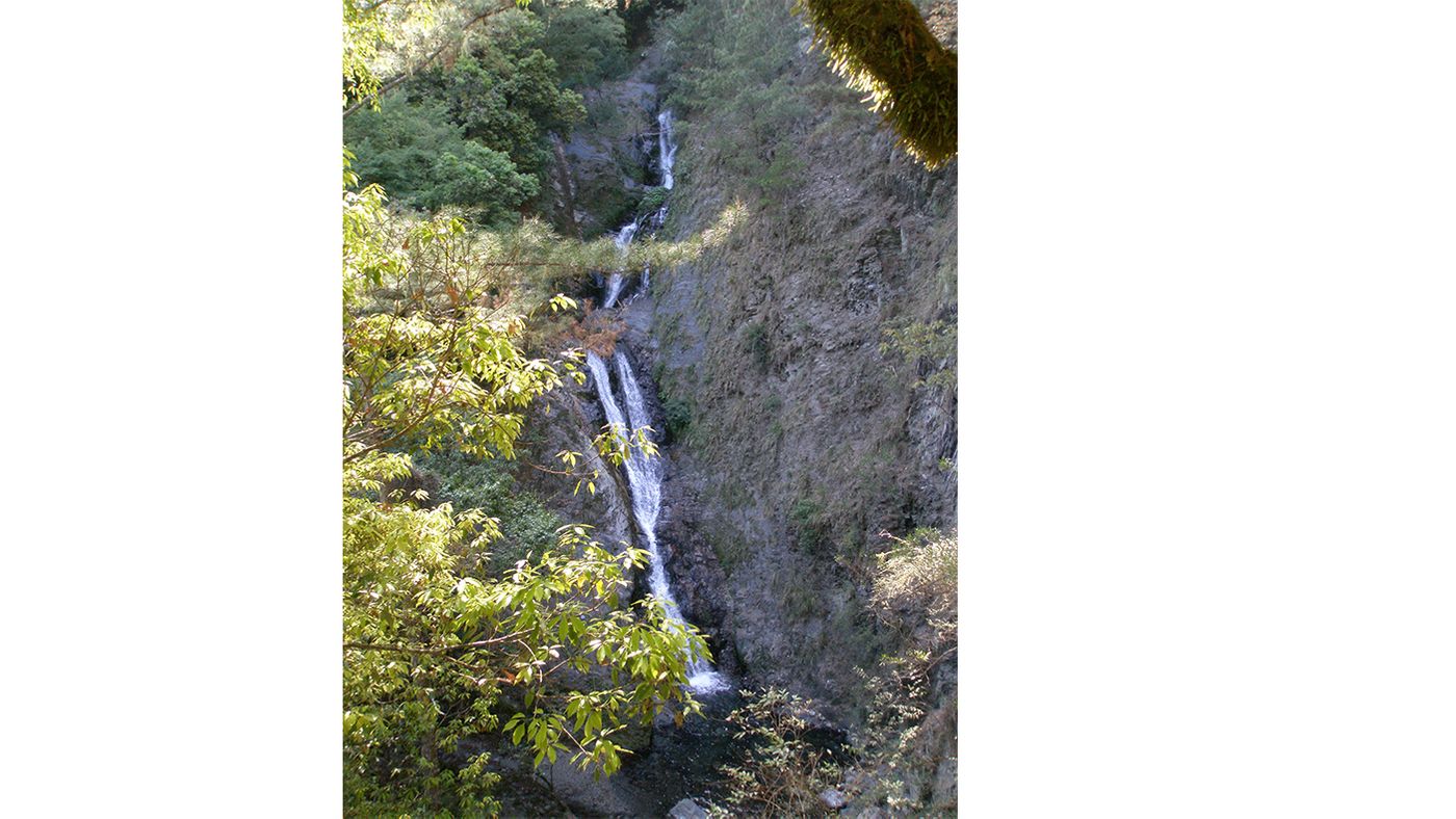
Sure enough, there is no doubt that the words are correct!
About 20 minutes away from Oita Falls, the author's writing of the Lagoura residence, which was entirely made of wood 90 years ago, is even more desirable.
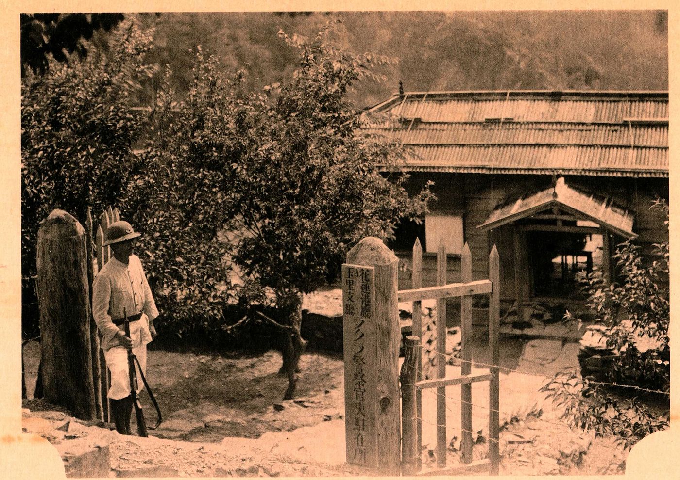
Although the place where I live has been reclaimed by nature, it is fortunate that human beings invented "photography" and "Internet", which allows me to sit at home leisurely, easily think about the scene 90 years ago, and even have a glimpse. The way it was at the time.
Follow the author's footsteps and carefully cross the Tu Ge collapsed wall. The difficulty of going retrograde is more difficult than going straight. The unclear path even makes the experienced author have to search along the way until he returns to the ancient road. up to the main line.
The precipitous collapse of Tu Ge and mountain disasters have been heard from time to time. The most recent one happened in 2020 not long ago. The author even personally participated in the rescue of one of the mountain disasters. However, when Tu Ge fell, all that could be retrieved was the comfort to the living family members, and his life must have been lost.
What climbers can do for themselves is nothing more than complete preparation in advance. Whether it is physical fitness, route planning, diet planning, or even weight-bearing capacity, every detail can increase our chances of returning home safely.
The distance between Lagula's station and Tuge's station is about 3.5 kilometers. After the author's physical exhaustion has calmed down, the next step is the rumored " Thomas station " (about 8KM away from the previous section, about 1995M above sea level, climb up about 435M).
Regrettably, I could not find any picture information for reference, whether it was the "Ta Dafen Station", "Isila Station" or even "Thomas" I passed by on the way.
Fortunately, according to the author's description, I can run through the past and present of these residents with red blood in the incidents of raiding police that I brought into the year from time to time.
As the height climbed, the author's next stop was the former cypress temple " Sachalabi Residence " (about 1.7KM from the previous section, about 2200M above sea level).
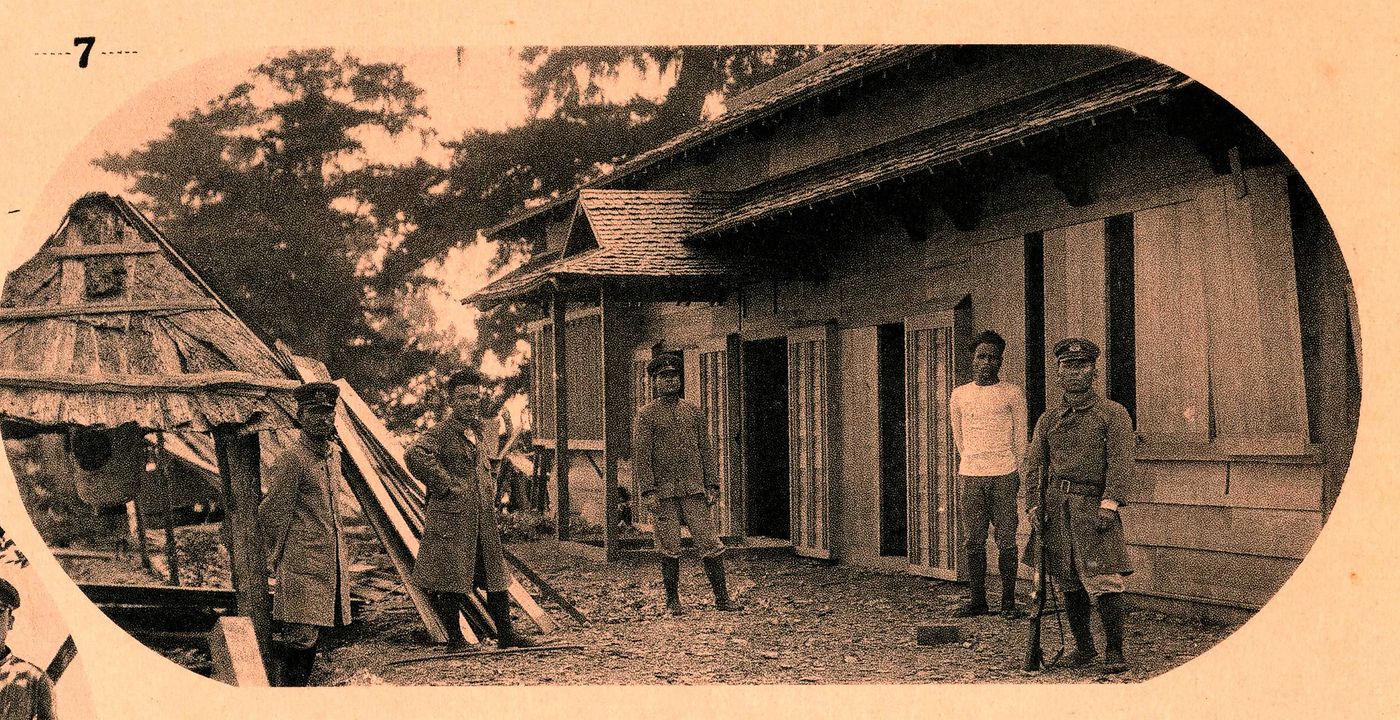
Even from the photos, you can still feel what a gorgeous wooden building should have been at that time, but it was actually built for sad and bloody reasons.
For the time being, I will stop thinking about historical events and follow the author’s footsteps again. The next stop is the “ Miyasan Residence” (about 4KM away from the previous section, about 2645M above sea level).
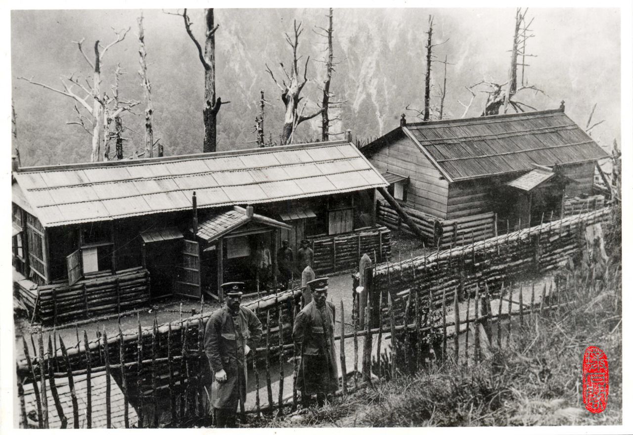
In Mia Sang, where there is nothing left now, the author can't stay for too long. As the altitude rises, the altitude has almost reached the position of a high mountain, which is a big test for physical fitness. After repairing, continue to the next target " Dashui Cave Mountain House " (about 4.3KM from the previous section, about 3220M above sea level).
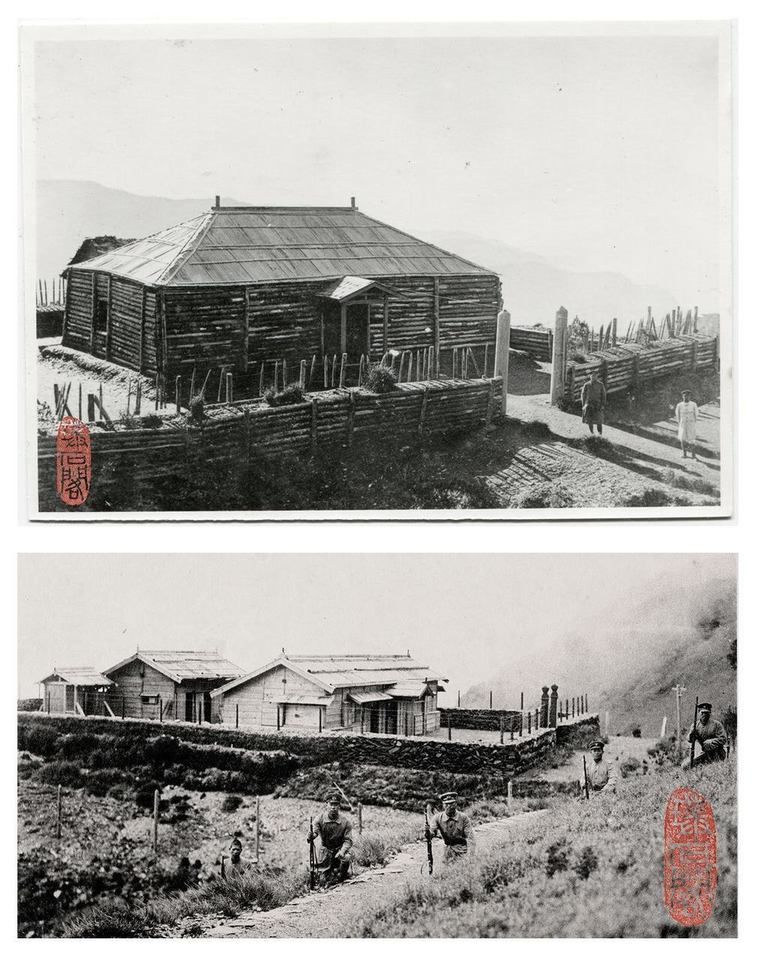
Climbing up to a height of nearly 600 meters in a four-kilometer journey on a high mountain is really hard!
Fortunately, the Dashui Grotto, which used to be like an iron wall in the past, has now been transformed into a comfortable mountain house for mountain friends to rest. However, there were a lot of people who stayed overnight, so the author only "passed by". According to the angle of the photo and various speculations, after a good inspection of the Dashui Grottoes, continue to the next stronghold " South Camp " (about 2.2KM from the previous section, about 3215M above sea level).
The author spends a comfortable night in the southern camp, and then walks about 3.5 kilometers forward, which is the " Cuckoo Camp " at an altitude of 3112M.
In the past, it was the " Zhuzuo Station ", and it is not known when it was renamed the Rhododendron Camp. However, Zuzui was the old name of the ancient cuckoo, which may be the reason for the name of the station.
The author found a wine bottle garden in the Rhododendron camp. Dilapidated wine bottles are a feature of the entire eight customs clearance. These remaining wine bottles can be seen in many stations. In that sad and depressing era, these wine bottles shipped to the Alpine Station may be the spiritual comfort of the Japanese police stationed there!
He ran away from La Jolla to the "escape" of the people of the county, so that in the end, La Jolla gave antlers and chose to surrender. This history of blood and tears is about to come to an end with the author's journey.
At the " Yunlong Suspension Bridge " (about 1645M above sea level), which is nearly 30 kilometers away from the Rhododendron camp, there will be mountain friends who promised to welcome them a few days ago, and the author will draw an end to the journey together.
This 255-page cross-ridge vertical line filled my heart with unspeakable emotions, and also full of imagination about the eight customs clearance.
Whether you want to go through the eight customs clearance, have no way to go through the eight customs clearance, or never want to climb the mountain, "Yueling Ji" is not only a book about mountains, it also carries the history of Taiwan, and writes that A historical fact that happened. On a sunny afternoon, maybe it's time to walk into the ancient and modern world of the "Yueling Ji" together.
Like my work? Don't forget to support and clap, let me know that you are with me on the road of creation. Keep this enthusiasm together!


