
IYP 不是过眼云烟的新闻网站,我们提供实战能力,这里是值得您反复回看的档案室:iyouport.org
What to do with all the confusion? Introduce a very important method of information verification and in-depth investigation
- It's important that you master it and at the same time not let it master you

The methods presented here are an important skill for fact-finding, information verification, and intelligence analysis work.
It has been introduced before, such as here " Extensive data collection is not the purpose, answering questions is: a powerful tool that can be carried with you to assist in-depth investigation "; another example is a demonstration " Disinformation Game: How to defeat the complex information environment of social networks" Conspiracy theory? 》.
Because it is very important, this article will talk about it again from another more complete perspective.
The Detective Challenge mini-game is a great platform to demonstrate how this approach can be applied, both to small OSINT puzzles and to broad and complex investigations.
Remember the detective game? You can review it below:
- " Where is that military vehicle heading? " :Detective Challenge Time 》
- " Detective Challenge Game: Two Methods for Quick Geolocation "
- " Detective Challenge: Circumstantial Evidence and the Method of Exclusion "
- " Detective Challenge Mini Game "
- " Detective Challenge Time: Let the Manhole Cover Talk to the Bicycle "
If you are experiencing information overload, a gap analysis can help you develop a framework to evaluate information and determine what to focus on and what not to focus on.
Likewise, if you start with little information, a gap analysis is a systematic way to assess what you have (often more than you think) and start planning from there how to go deeper.
What I want to demonstrate today is still an interesting topic in the detective challenge game. This is a post by Julia Bayer that shows how to use this methodical approach to solve difficult problems that may seem insurmountable at first.
The title of this challenge is the following photo:
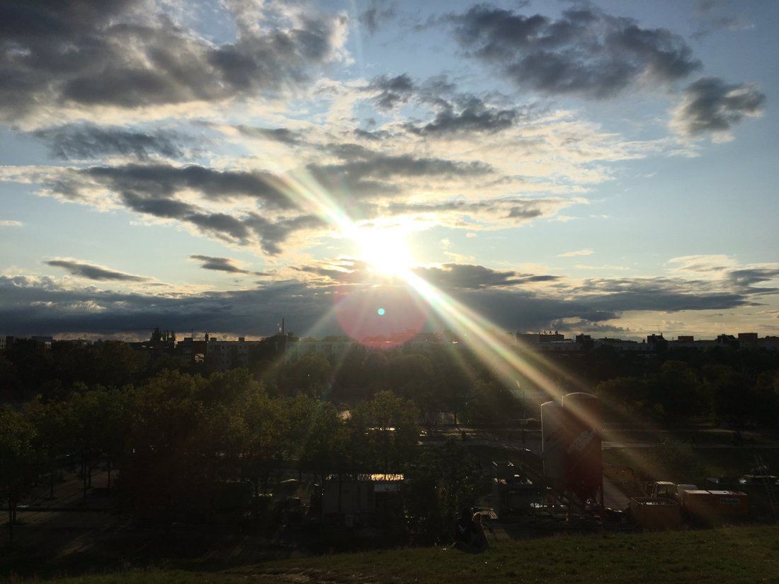
Julia said she took the photo over the weekend, October 5-6, and asked about the exact date and time it was taken.
At first glance it may seem like it's about time, however, the first thing you need to do is the location, as it's impossible to know the time unless you first know where you shot it .
What is gap analysis?
A gap analysis is really just a simple way to sort through the information you have, determine what you need to work on, and then come up with a structured response to drive investigation.
It's a good servant but can be a terrible master, so don't let that stop you from thinking.
⚠️A mistake that is absolutely guaranteed to occur in any type of investigation is making unnecessary assumptions at the beginning, then conducting the investigation on the basis of those assumptions, and then going down the wrong path. Cases constructed this way will eventually fall apart completely.
You need to avoid this.
A gap analysis asks four simple questions :
- What do I know
- what does that mean
- what else should i know
- how do i find them
It's that simple.
Spending time on the first question is the most important. Note that only the fourth question results in asking "What tool do I use?"
💡Before choosing the tools you need, you must first plan and choose a method - this is why the way you think is more important than the tools.
So how does this apply to this challenge game?
This process will be demonstrated step by step below. Starting with the first question:
1. What do I know?
- This photo was taken by Julia Bayer
- Julia used to live in Cologne, but some of her recent posts have been in Berlin
- This photo was taken on October 5th or 6th
- The sun was very close to the horizon at that time
- The photographer was standing on some kind of hill
- In front of the field of view is a construction site
- There seems to be a park or public walkway
- There is a gap between the "park" and the apartments - maybe a canal, a railway, a creek or something like that

- On the front are some apartments
- There are few distinguishing features on the horizon, but there is a tall chimney in the distance
So, there we have ten facts about the photo . Please note that points 1–3 above are not included in the photo itself – they are relevant to the photographer. ⚠️Studying the information carried by the image itself is sometimes more important than the image,
Now to the second question. Please note that each number below corresponds to a numbered point in the question above.
2. What does this mean?
1/ If you can know where the questioner has been recently, you can roughly guess the shooting location.
2/ Julia is probably in Berlin. Her most recent tweet is from Berlin. But it’s not certain, and in the absence of any other clear city choices, start with Berlin.
3/ With position estimation , you can find very suitable parameters to determine the time.
4/ This means it is either after sunrise or before sunset . First, I'm going to assume it's closer to evening. If that's the case, then the person taking the photo would be facing approximately west (or directly east if it's morning).
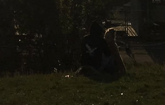
5/ The position of the photographer seems to be on hills or some kind of undulating ground because it is relatively high.
6/ That construction site is such a nuisance, they are short-term and temporary so don't usually show up on maps and satellite images. This may also indicate that demolition work has been carried out here in the past, so some of the satellite imagery may be out of date if the buildings were demolished etc. One shouldn't rely too much on this.
7/ If there was a way to show all the parks on a map it would help narrow down the search (there is such a way!).
8/ This gap is interesting. It looks too small, as the Spree is much larger, but it may be some form of canal. And there is no sign of a railway.
9/ This guess is important and will help confirm the orientation of the photo. If you find the right location, you can find the apartment using Street View and Google Earth to reconstruct the photographer's view .
10/ Chimney ! This is important because there are not many modern cities today. If you assume that the photographer is facing west (as per #4 above), you should be able to find a tall chimney in Berlin and orient your perspective on the straight line between east and west.
Alternatively, assuming that the above speculation is wrong, that is, the photographer is facing east, then the position can still be found by looking in the opposite direction of the chimney. Hopefully Berlin doesn't have too many tall chimneys.
3. What else should I know?
A small framework of inquiry has begun to take shape. Point 10 above is clearly the most important issue and will therefore be a priority. This means I need to know the following:
1/ Where is the tallest chimney in Berlin? What do they look like? Like this photo?
2/ How many chimneys are there? (If there are hundreds, it may take a long time, don't be afraid it's impossible)
3/ If you find a chimney, can you use this as a base point to move east-west and find a location that matches all the other criteria above? There’s only one way to find out…
4/ How many parks are there in Berlin? I needed to find a park that was close to a canal or any unusual gaps, and the chimney also had to be aligned correctly.
4. How do I find them?
1/ The image search " schornstein + Berlin " (chimney + Berlin) will show images of chimneys.
2/ By studying images in Google, chimneys can be identified and located on Google Earth based on what they find. A Google Maps 3D view is also available, but Google Earth will allow you to add annotations, which will help with orientation.
3/ Google Earth will also identify the park on the map, which will help focus on the location.
4/ This is what I do next. If you get stuck, just recheck the gap analysis plan with the updated findings and repeat the process again until you find the answer.
Put the plan into action
The first thing this plan will do is load Google Images and Google Earth. Here are the results for searching " schornstein + berlin ":

It's immediately clear that one particular chimney appears several times - for some reason it has to be at the top of the search results.
There's a unique red and white pattern on the top, and then the same pattern appears again on the lower half. Of the first 18 results returned, there were 5 matches. This frequency is more frequent than any other chimney in Berlin, so it's a good starting point.
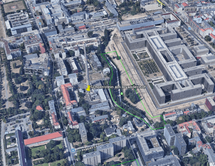
A quick click on the matching image reveals that this is the chimney of the Invalidenhof in the Mitte district of Berlin .
Now find it and mark it on Google Earth :
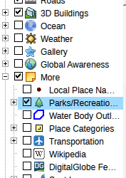
Enable the "Parks/Recreation" layer on Google Maps. Gap analysis identifies the right locations that may have a park in the foreground, so highlighting them will help identify areas faster:
Assume the photographer is facing approximately west. So if this chimney is the one on the back left facing west, I should be able to orient myself so that the chimney appears on the back left of my Google Earth view.
So I added two lines of content in Google Earth to help plan the direction I wanted to take. The aim is to recreate the same view of the chimney.
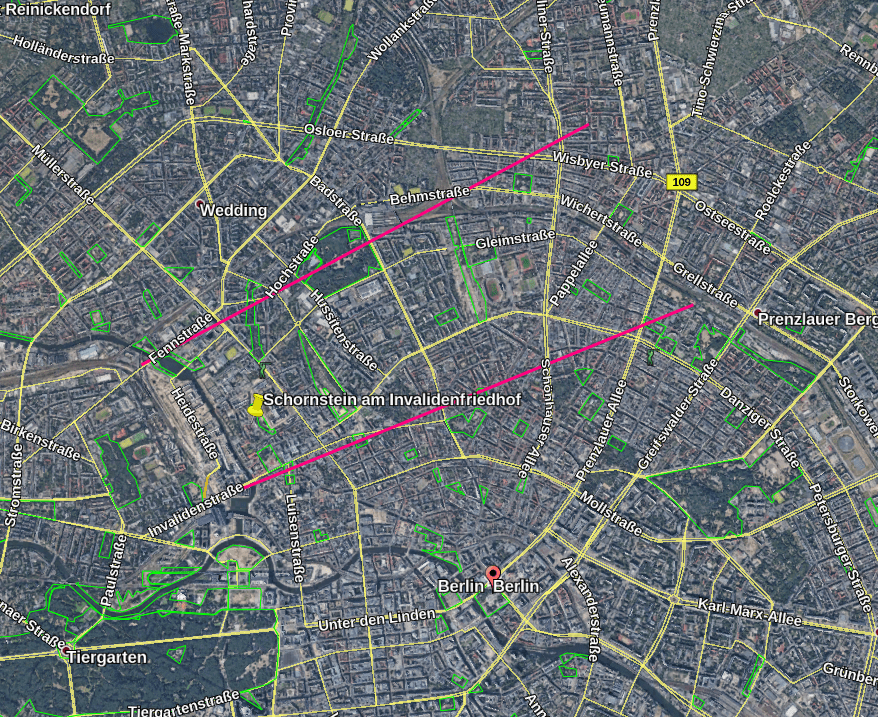
If the front is right, that is to say the target chimney is right, and the time assumption is also right (i.e. dusk, looking west), then the photographer's position is between the two pink lines in the picture above.
There are several parks in the area as well, I will check more closely to determine which one it is. The next step is to reorient my own perspective so that the chimney appears to the rear left of my view like in the original photo.
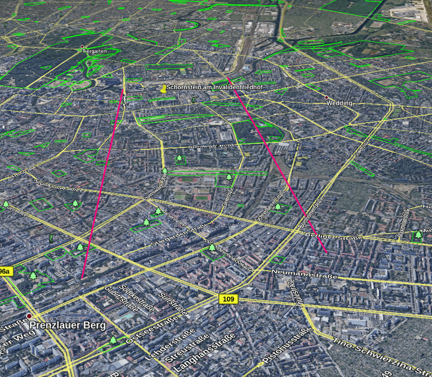
Then it became clear that there was a park next to a vacant lot, facing a row of apartments. This will satisfy all the criteria identified in the gap analysis . So this is the first place to check out:
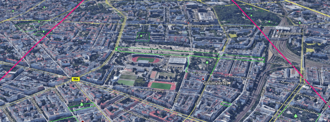
Bring it closer:
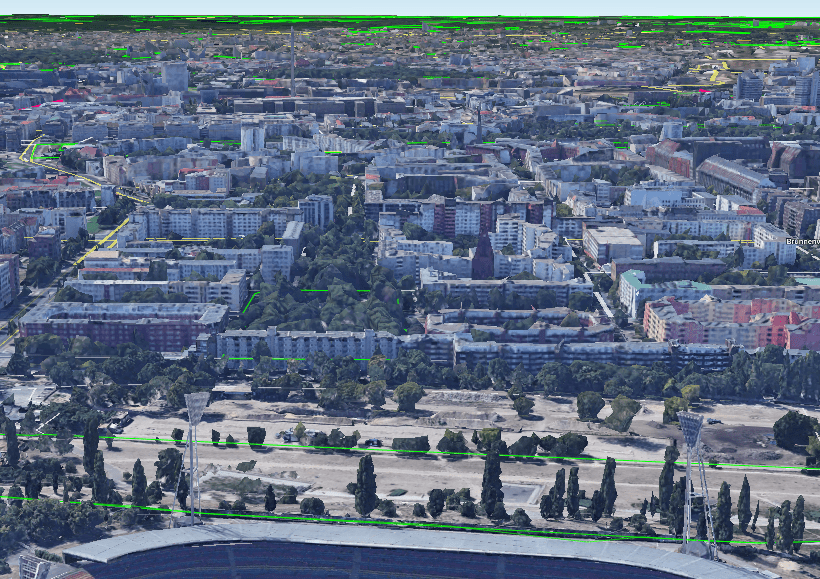
A little closer:
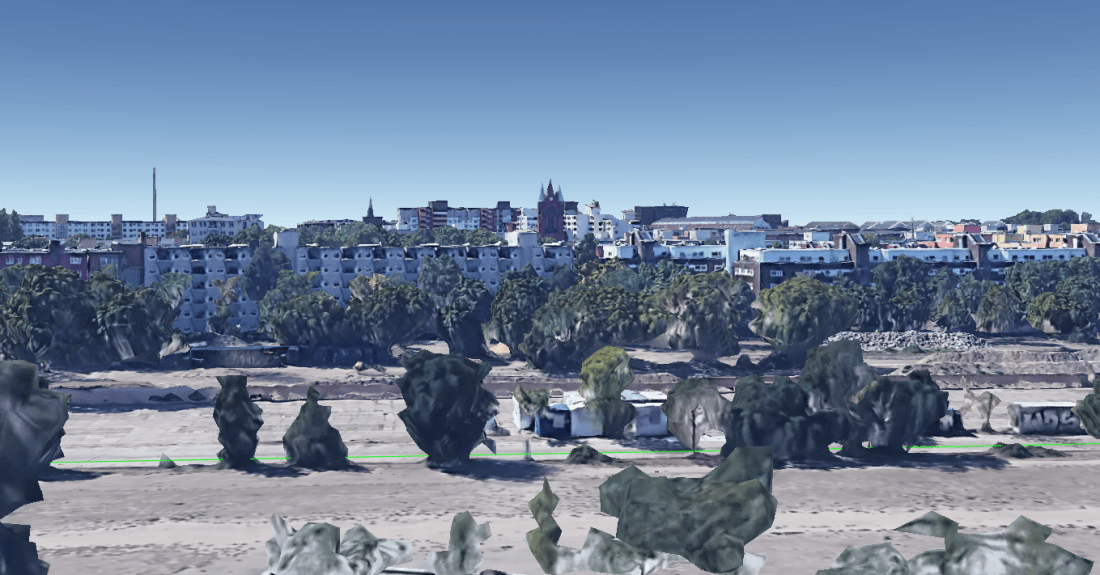
Wow!
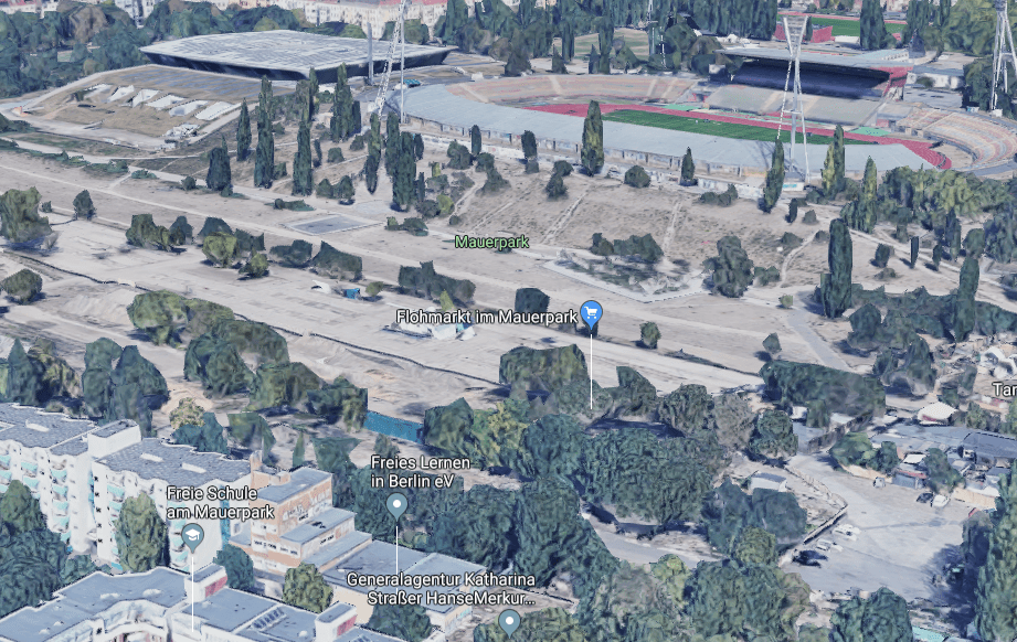
The tall chimney at the rear left, the apartment that matches the photo, the park in the foreground (actually the Mauerpark ), the hill (actually the embankment behind the Friedrich Ludwig Jahn Sports Park ) and The unusual gap between them is actually the former Berlin Wall.
This is the photographer's view when looking from the other direction:
time and date
The hard part is done. Now all that’s left is to find the time to shoot.
The photographer tells us at the beginning that she shot it on a weekend, see the release date, which means there are only two possible dates, October 5th or 6th.
Or first try: Is the video of being handcuffed at a Xinjiang train station true? Where was it filmed ? 》The method used in the demonstration .
That is, use Suncalc to calculate the approximate time based on the position of the sun and the length of the shadow:
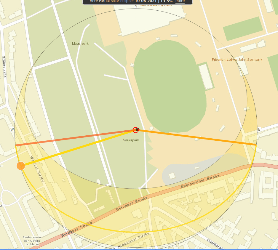
⚠️For Xinjiang Railway Station, it works well, but for this case, Suncalc is difficult to accurately grasp the latest time.
Presumably this means that the photographer took this photo around 17:45 local time, but possibly earlier, like 17:30, or even later, like 18:00, with only a few degrees in between.
It's easier to calculate time than date!
As we've demonstrated before - use historical weather records and try to match weather conditions to images in photos. See here " Information Verification Tips: How to Determine When a Photo was Taken?" 》
This one is obviously simple, ⚠️but it must be said that sources of historical weather records can be inaccurate, and different sources often conflict. Weather stations are also often too far away from your location of interest. These must be taken into consideration.
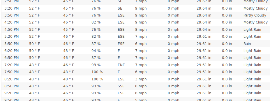
For this challenge, Wunderground was used to compare different weather patterns in Berlin on October 5th and 6th, although Wolfram Alpha would also work well.
Note that Wunderground actually gives results for Berlin-Tegel Airport, which is somehow the exact location of the photographer (it's northwest of Berlin, to the right of this photo).
Here's the weather for Saturday at the relevant times:
For comparison, here's what it's like for Sunday:

So you see, Saturday will be cloudy and Sunday will be sunny with lower humidity. So Saturday October 5th should be the correct date.
MCantow proposed a simpler solution to this part of the challenge by using historicalsatellite imagery to examine cloud cover . This is a Saturday in Berlin at the relevant time:
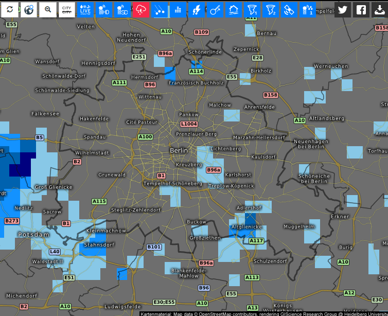
There are clouds west of Berlin, as can be seen in this photo. Compare this to Sunday, when there were almost no clouds:
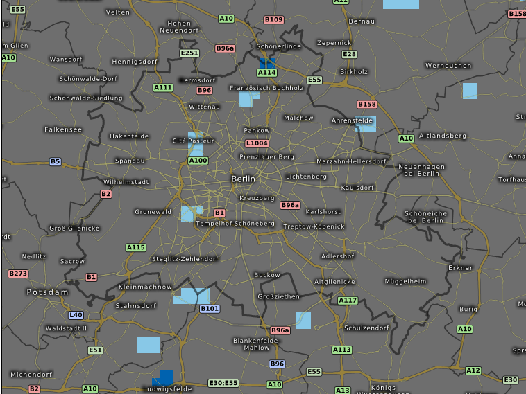
Therefore, it is safe to assume that Saturday is the most likely date.
at last
Gap analysis does work. It's not magic, of course, but it does help you evaluate the information you have in a more systematic way .
It can also help you adopt an investigative approach that focuses on what's important , rather than spending time digging into noisy questions that won't help.
That's it, have you learned it? ⚪️
Like my work?
Don't forget to support or like, so I know you are with me..
Comment…