目前主要是詭秘之主瞎說系列、溯源系列連載進行中
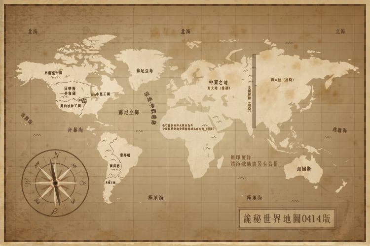
Secret world map version 0414

It is mainly to update the range of Jianhai, and the adjustment of the borders of the countries in the North Continent, plus some conjectures about the land abandoned by the gods
According to 2-93
"Jianhai is the natural dividing line between Loen, Intis and Feysac. The east coast belongs to Loen, most of the west coast belongs to Intis, and to the north are the famous port cities of the Feysac Empire. For example, Indo.
In addition, the Jianhai also spread to the northeast, penetrating through the territory of the Feysac Empire, and connected to the North Sea. There are many islands in that part of the sea, which are the habitats of animals such as ice bears and seals. "
make adjustments
So I posted the map a little bit... Is the map of the mysterious world actually like this?
Then Backlund's prototype may be Washington State, which is also the rain capital on the east coast of the United States, and Tingen's prototype is probably Cambridge, Massachusetts.
In this way, the place names of the Highland Kingdom are also understood. It probably corresponds to the Andes Mountains, and the Hornaches Mountains are probably the Apache Mountains.
To be honest, I gave my geography back to the teacher...
Like my work?
Don't forget to support or like, so I know you are with me..
Comment…